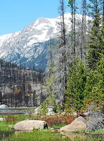
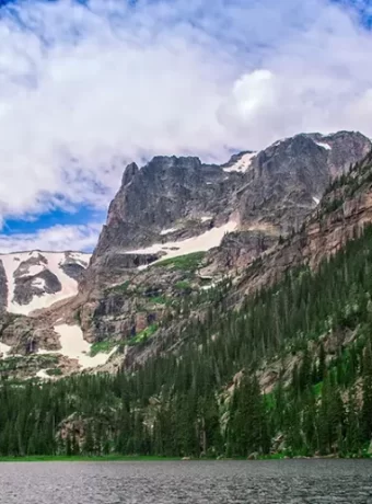
Arc Dome Guide: History, Hiking, Fly Fishing & Camping
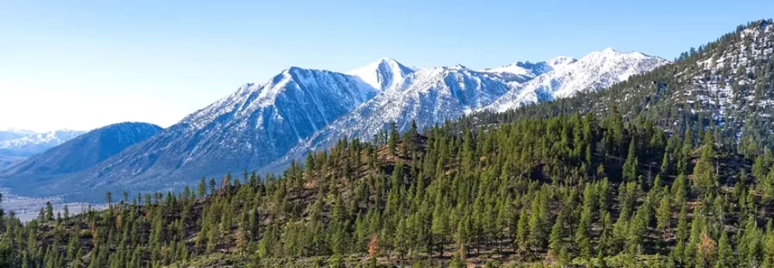
Thinking about exploring a truly wild part of Nevada? You might have stumbled upon the Arc Dome Wilderness Area, a place brimming with rugged mountains, deep canyons, and quiet streams within the vast Humboldt-Toiyabe National Forest. This guide covers the Arc Dome Wilderness Area History Hiking Fly Fishing Camping Guide, giving you the lowdown on what makes this place special and how you can experience it.
Maybe you’ve heard whispers about its tough trails like the famed Toiyabe Crest Trail or the fish hiding in its creeks such as the Reese River. Perhaps you’re just looking for a place to escape the noise and connect with nature in one of Nevada’s pristine wilderness areas. This area offers all that and more, and this Arc Dome Wilderness Area History Hiking Fly Fishing Camping Guide will help you plan an amazing adventure in this beautiful part of central Nevada.
Table of Contents
Whispers of the Past: History of Arc Dome Wilderness Area
The land encompassing the Arc Dome Wilderness area wasn’t always a protected wilderness. Its story stretches back thousands of years, long before maps showed the state of Nevada. It’s a story written in stone, carried on the wind, and echoing in the quiet canyons of the Toiyabe Range.
Native American Presence
For centuries, this region was home to the Western Shoshone people. They knew this land intimately, moving with the seasons across the mountain range to hunt, gather plants, and find shelter. Imagine living off the land here – relying on the pinyon nuts or finding game near vital water sources like the Reese River or Twin River systems.
Evidence of their lives, like old campsites and rock art, hints at a deep connection to these mountains, some of the highest summits in the region. They didn’t just survive here; they built a way of life tuned to the rhythms of the Great Basin high desert. Their legacy reminds us of a different way of relating to this unique part of the national forest.
Their traditional lands extended across the river valley, a testament to their adaptability in this sometimes harsh environment. Today, respecting the cultural heritage sites found within the dome wilderness area is crucial for visitors. Remnants of their passage add depth to any backpacking trip.
Arrivals and Changes
Things started changing when European explorers and settlers arrived. Jedediah Smith likely saw the towering Toiyabe Range back in 1827. John C. Fremont’s mapping expedition in 1845 really put the area, including places near modern-day Nevada Austin, on the map for outsiders.
Then came the silver rush. Discoveries nearby in 1862 brought waves of prospectors chasing fortune into central Nevada. Towns like Belmont, now a fascinating ghost town, and Ione sprung up, full of hope and activity that changed the landscape and dramatically affected the Shoshone, displacing them from their ancestral lands near the wilderness boundary.
The influx significantly altered the ecological balance, introducing new demands on resources. Some traveled near what is now the loneliest highway to reach these boom areas. Understanding this period adds context to the region’s development.
Mining and Ranching Days
For decades, mining defined the economy around the Toiyabes, one of Nevada’s significant mountain ranges. Mines popped up, pulling silver and gold from the hillsides near areas like Kingston Canyon. You can still find signs of this era – old mine shafts, leftover rock piles, and maybe even bits of forgotten equipment if you look closely near the dome area.
Simultaneously, ranching took hold in the vast Reese River Valley and Big Smoky Valley. Huge herds of sheep grazed the slopes, often managed by Basque sheepherders who left their own mark. These herders carved messages and drawings, known as arborglyphs, onto aspen trees, which you can still spot today along trails.
This intensive use wasn’t without consequences, impacting the delicate high-desert ecosystem. Overgrazing damaged native grasses, and mining activities altered waterways like South Twin River. Wildlife, especially the native desert bighorn sheep, struggled with habitat changes and diseases from domestic animals.
Protecting the Wild
Slowly, recognition grew about the value of preserving places like the Toiyabe Range. In 1907, the area became part of the Toiyabe National Forest, managed by the Forest Service. This was a foundational step towards more careful resource management.
The real push for stronger protection came later, fueled by the environmental movement of the 1970s. After much debate and study, Congress passed the Nevada Wilderness Protection Act. In 1989, President George H.W. Bush signed it into law, officially designating the 115,000-acre Arc Dome Wilderness.
This designation as a wilderness area prohibits roads, motorized vehicles, and major development, preserving its wild character. It helps keep the arc dome wilderness area pristine, offering solitude and a connection to a less-touched world for visitors seeking wilderness areas nevada. Today, it stands as a protected space for plants, animals like desert bighorn, and people seeking quiet adventure miles north of major cities.
Lace Up Your Boots: Hiking in Arc Dome
Ready to hit the trail in this designated wilderness? Arc Dome Wilderness has miles of paths waiting, from high ridges offering huge views to creekside strolls through canyons like Cow Canyon. Hiking here requires preparation, but the rewards are immense for those undertaking the challenge.
The trail system is varied, connecting different parts of the dome wilderness. Some sections, like parts of the crest trail, are well-maintained, while others feel more rugged and remote, demanding good navigation skills. You really need to be prepared for changing conditions and know how to find your way across the mountain ranges.
Exploring the Trails
With over 100 miles of trails, choosing one can seem like a big decision for your backpacking trip. The main artery is the renowned Toiyabe Crest National Recreation Trail (TCT). About 30 miles of this significant recreation trail slice through the heart of the wilderness, often staying high on the ridges of the Toiyabe Range.
Imagine expansive views across Nevada’s basin-and-range country, stretching towards distant peaks like White Mountain. You’ll hike through sagebrush flats characteristic of the Great Basin, forests of pinyon and juniper, and perhaps find aspen groves or alpine meadows higher up. Keep an eye out for mule deer or maybe even a golden eagle soaring overhead while enjoying this national recreation trail.
The trail starts are often accessed via Forest Service roads, leading into the heart of the Nevada wilderness. Remember that the Toiyabe Crest Trail runs north-south, offering many possibilities for point-to-point or loop hikes. Many sections of the trail continued to be used by hikers year after year.
Major Hiking Trails
Here’s a look at some key trails to consider for your hike arc dome adventure:
- Toiyabe Crest Trail (TCT): This is the defining trail of the arc dome wilderness area. Expect moderate to difficult hiking, especially with significant elevation changes common in the Toiyabe Crest. You can hike segments of it, like the popular stretch near Arc Dome peak itself; the crest trail runs near many points of interest. Access points like Stewart Creek Trailhead or trail starts near Ophir Summit make tackling sections easier.
- Arc Dome Summit Trail: Feeling ambitious? This tough, roughly 13-mile round trip takes you to the top of Arc Dome, the highest mountain in the range at 11,775 feet. It’s a serious climb with over 4,000 feet of elevation gain, starting near Columbine Campground. The payoff is unbelievable 360-degree views across central Nevada, sometimes reaching the Sierra Nevada. Make sure you’re acclimated and prepared for steep terrain; the dome trail is challenging. Find more trail details and reviews on resources like AllTrails.
- Stewart Creek Trail: This is a more approachable option, roughly 5 miles long depending on how far you go. It follows Stewart Creek through pleasant forest, offering shade and the sound of water, making it a good canyon trail experience. It connects to the TCT, so you can use it for a shorter day hike or as access to the higher toiyabe crest trail; the trail continues upward. Good for families or those easing into wilderness hiking near the arc dome area.
- North Twin River Trail: Heading over to the east side, accessed perhaps after traveling headed east from the main highway, this trail follows the North Twin River, one of the two main twin river drainages. It winds through canyons with interesting rock formations and cottonwood trees typical of a river valley. It often feels quieter than the TCT and offers chances to see different wildlife, possibly including desert bighorn sheep near North Twin.
- South Twin River Trail: Similar to its northern counterpart, this trail explores the South Twin drainage on the east side. Following the South Twin River, it offers solitude and access to the higher elevations of the Toiyabe Range. Access might involve rougher roads, potentially requiring high-clearance or all-wheel drive vehicles.
- Cow Canyon Trail: Another option for exploring the wilderness, this canyon trail offers a different perspective on the varied terrain. Check Forest Service maps for details on its length, difficulty, and current conditions. This trail might be less traveled, providing more solitude.
- Sawmill Creek Trail: Accessing areas potentially including Big Sawmill Creek, this trail offers another route into the wilderness. It likely involves creek crossings and varying terrain common to the national forest. Research its specific characteristics before attempting it.
Don’t Miss These Sights
While hiking, watch for interesting features within the dome wilderness:
- Glacial Cirques: Near the headwaters of Stewart Creek and the Twin Rivers, look for bowl-shaped depressions carved by ancient glaciers, remnants of a colder past.
- WWII Plane Wreckage: On Arc Dome’s west slope lies the scattered remains of a B-24 bomber that crashed in 1945. It’s a somber piece of history amid the vast Nevada wilderness.
- Aspen Carvings (Arborglyphs): Keep an eye on older aspen trees along trails, especially near water sources. You might find names, dates, or drawings left by Basque sheepherders long ago, part of the area’s rich cultural tapestry.
Setting Up Camp: Your Home Away From Home
Spending a night (or several) under the vast Nevada sky in the Arc Dome Wilderness is a memorable experience. You have choices: established campgrounds near the edge or finding your own dispersed spot deep within the backcountry. Both options offer unique ways to connect with this part of the Humboldt-Toiyabe National forest.
Campground Options
If you prefer a designated spot with basic amenities like a picnic table and fire ring, two small campgrounds sit just outside the wilderness boundary:
- Columbine Campground: Located near the Stewart Creek Trailhead on the west side, this is a popular starting point for those aiming to hike Arc Dome. It has about 6 sites nestled among trees, offering access to Stewart Creek. Expect it to fill quickly, especially on weekends during peak season.
- Peavine Campground: Found on the southern edge of the dome wilderness area, near Peavine Creek. It usually has around 5 sites and tends to be quieter than Columbine Campground. It provides good access to southern trails within the Toiyabe Range.
These campgrounds operate on a first-come, first-served basis. They offer basic amenities like vault toilets but lack potable water and trash service – you must pack everything in and out. Check the Humboldt-Toiyabe National Forest website for current status and fees, if any.
Backcountry (Dispersed) Camping
For genuine solitude and a deeper immersion in the Nevada wilderness, you can camp almost anywhere within the wilderness boundaries away from developed sites. This is dispersed camping. Adhere strictly to Leave No Trace principles: set up camp at least 100 feet (about 40 big steps) away from lakes, streams like the South Twin River, and trails.
Popular areas for backcountry camping include spots along the Toiyabe Crest Trail for breathtaking views, or sites near reliable water sources like the North Twin River or Reese River headwaters. Selecting a durable surface, such as bare ground or pine needle duff rather than fragile meadows, is crucial for minimizing impact. Planning your backpacking trip route often involves identifying potential dispersed camping locations.
Camping Rules & Tips
- Permits: Remember the free wilderness permit required for all overnight stays within the designated wilderness boundary. Pick one up at the trailhead parking lot register or the Forest Service office.
- Campfires: Use existing fire rings only in developed campgrounds like Columbine Campground. In the backcountry, campfires might be allowed below 9,000 feet, but restrictions are frequent, especially during dry summer months. Using a lightweight camp stove is always the preferred and lower-impact option. Always check current fire restrictions imposed by the Humboldt-Toiyabe National forest service before your trip – fire bans are common.
- Food Storage: Bears, mountain lions, and smaller critters are attracted to food smells. Use a certified bear-resistant canister for all food and scented items, or properly hang your food bag at least 10 feet high and 4 feet away from the tree trunk and limbs. Proper storage protects both wildlife and your supplies.
- Leave No Trace: This is fundamental to protecting wilderness areas. Pack out absolutely everything you pack in, including all trash, toilet paper, and food scraps. Minimize your impact by staying on established trails and camping on durable surfaces. Observe wildlife from a distance and never feed them. Familiarize yourself with all seven Leave No Trace principles before your visit.
- Water: Filter or chemically treat all water collected from streams or lakes before drinking to prevent waterborne illnesses. Even clear-looking water can contain harmful microorganisms.
- Weather: Be prepared for rapid weather changes common in mountain ranges. High elevations mean potentially cold nights even in summer, and afternoon thunderstorms can develop quickly. Dressing in layers is essential for adapting to changing conditions.
Fly Fishing Destinations
Did you know the Arc Dome Wilderness area offers excellent opportunities for fly fishing? The clear, cold mountain streams flowing through this part of central Nevada hold wild trout populations. Anglers seeking solitude and beautiful scenery will find rewarding experiences here, though accessing the best water often requires hiking.
Where to Fish
The primary streams to target within or originating near the Arc Dome Wilderness include:
- Stewart Creek: Accessible from the west side near Columbine Campground, known for holding rainbow trout and potentially some brook trout. The lower sections are easier to reach via the Stewart Creek Trail.
- North and South Twin Rivers: Found on the east side of the Toiyabe Range, these streams cut through scenic canyons within the dome wilderness. They hold populations of rainbow trout and brown trout, with brook trout possibly present in smaller tributaries like Big Sawmill creek or Sawmill Creek if they flow into this system. Accessing these often requires navigating forest roads headed east from the main routes.
- Reese River Headwaters: Parts of the upper Reese River system originate within or near the wilderness boundary. Exploring this drainage can offer opportunities for anglers hiking the Toiyabe Crest Trail or accessing the area from the west, perhaps near the Reese River Valley floor approaches.
These streams are typically small to medium-sized, featuring pocket water, riffles, and pools. Careful wading and stealthy presentations are important due to the often crystal-clear water. Reading the water to identify likely holding spots is key.
What You Might Catch
The main content of your catch will likely be wild trout. Expect to encounter:
- Rainbow Trout (often the most common)
- Brown Trout (can be more elusive, found in deeper pools or undercut banks)
- Brook Trout (may inhabit colder, smaller tributary streams)
These trout are generally not exceptionally large, but catching wild fish in such a pristine wilderness setting is the true reward. Respecting the resource is paramount; consider practicing catch-and-release, especially for larger, spawning-sized fish, to help sustain healthy populations for the future. Proper handling techniques minimize stress on the fish.
Best Times and Techniques
Late spring, after the main snowmelt runoff subsides (typically June), through early fall (October) marks the prime fly fishing season in the Arc Dome area. During this period, water levels are generally favorable, and trout are actively feeding. Summer afternoons can bring thunderstorms, so early starts are often wise.
Standard fly fishing techniques are effective here:
- Dry Flies: Good choices include general attractor patterns like Parachute Adams, Stimulators, Elk Hair Caddis, and terrestrial patterns like ants, beetles, or grasshoppers later in the summer. Observing active insects (“matching the hatch”) can improve success.
- Nymphs: Drifting small nymphs such as Pheasant Tails, Hare’s Ears, Copper Johns, or Zebra Midges under a strike indicator or using European/tight-line nymphing techniques works well. Focus on seams, pool tail-outs, and deeper runs where fish hold.
- Streamers: Casting smaller Woolly Buggers, sculpin patterns, or Clouser Minnows can entice larger, more predatory trout, particularly browns. Swinging streamers through runs or stripping them back can provoke aggressive strikes.
A lightweight fly rod, typically in the 3- to 5-weight range and 7.5 to 9 feet long, is ideal for these waters. Due to the water clarity, using longer leaders (9 feet or more) tapered down to fine tippets (5x-7x) can significantly improve your presentation and fool wary trout. Waders can be helpful for warmth and navigating streams, but wet wading is possible in summer.
Regulations and Ethics
A valid Nevada fishing license with any necessary stamps is required for all anglers aged 12 and older. Always consult the current Nevada Department of Wildlife fishing regulations booklet or website for specific rules. Pay close attention to seasons, daily limits, possession limits, size restrictions, and any special gear regulations (like single barbless hooks) that may apply to specific waters within the Humboldt-Toiyabe National Forest or the Arc Dome Wilderness itself.
Fishing within a designated wilderness area demands a strong commitment to Leave No Trace ethics. Pack out absolutely everything, including broken tippet, leaders, and any trash. Avoid trampling sensitive streamside vegetation. Handle any fish you catch gently and release them quickly if practicing catch-and-release, minimizing time out of the water.
Other Nevada Fly Fishing options include Fly Fishing for Bass and Great Trout Streams for Fly Fishing.
Arc Dome Wilderness Area History Hiking Fly Fishing Camping Guide Summary Table
| Activity | Key Locations | Best Season | Difficulty / Notes |
|---|---|---|---|
| Hiking | Toiyabe Crest Trail (TCT), Arc Dome Summit Trail, Stewart Creek, North & South Twin Rivers, Cow Canyon Trail | June – October | Easy stream walks to Strenuous summit climbs (e.g., hike arc dome); Navigation skills needed, trail runs vary. |
| Camping | Columbine Campground, Peavine Campground (developed, basic), Dispersed Backcountry Camping along trails/streams | June – October | Developed sites are first-come, first-served; Backcountry requires permits & strict Leave No Trace adherence. Parking lot available at trailheads. |
| Fly Fishing | Stewart Creek, North Twin River, South Twin River, Reese River headwaters, potentially Big Sawmill creek | June – October (post-runoff) | Requires hiking access; NV fishing license needed; Wild trout (Rainbow, Brown, Brook); Catch & Release highly encouraged. |
| History Exploring | Mining remnants near old sites, Basque arborglyphs on aspens, Native American sites (observe respectfully from distance) | Year-round (trail access varies) | Learn about Shoshone heritage, mining boom/bust cycles (nearby ghost town), ranching history in the river valley. |
| Wildlife Viewing | Throughout the wilderness area, especially near water sources and varied habitats | Year-round (animal activity varies) | Mule deer, desert bighorn sheep, marmots, pikas, potential for mountain lions, various birds. Observe respectfully. |
Plants and Animals You Might See
The Arc Dome Wilderness isn’t just dramatic peaks and winding trails. It’s a living landscape, home to a variety of plants and animals perfectly adapted to this rugged part of the Great Basin. Recognizing some of these species can add another layer of appreciation to your visit.
Flora: From Sagebrush to Pines
As you gain elevation on your hike, you’ll notice distinct changes in the plant communities:
- Lower Slopes (approx. 6,000-8,000 ft): Dominated by the iconic big sagebrush, rabbitbrush, Mormon tea, and various desert grasses. In spring and early summer, look for colorful wildflowers like Indian paintbrush, lupine, desert parsley, and sego lilies adding vibrancy to the landscape near the Big Smoky valley edges.
- Mid-Elevations (approx. 8,000-10,000 ft): This zone marks the transition into pinyon pine and Utah juniper woodlands, characteristic of many mountain ranges in Nevada. These hardy trees provide crucial food (pine nuts) and shelter for wildlife. You’ll also find sturdy mountain mahogany shrubs here.
- Higher Elevations (approx. 10,000+ ft): Groves of quaking aspen appear in moist draws and north-facing slopes, their leaves shimmering in the breeze and turning brilliant gold in autumn. Hardy limber pine becomes more common, clinging to rocky ridges. Near the highest summits, like Arc Dome itself or North Arc Dome, you might encounter low-growing alpine cushion plants adapted to the harsh wind and cold.
Fauna: Wildlife Encounters
Keep your eyes peeled for the inhabitants of the dome wilderness area, but always observe wildlife from a safe and respectful distance:
- Mammals: Mule deer are frequently seen, often browsing in meadows or near creek bottoms during dawn and dusk. You might be lucky enough to spot elusive desert bighorn sheep, especially navigating steep, rocky slopes – the Toiyabe Range is important habitat for Nevada’s bighorn sheep populations. Predators like mountain lions, bobcats, and coyotes roam the wilderness, though they are wary and sightings are uncommon; be aware of their presence, especially when camping. Smaller mammals are abundant, including yellow-bellied marmots sunning themselves on rocks, squeaking pikas gathering grasses in talus fields, various squirrels and chipmunks, and jackrabbits at lower elevations. Black bears are present in the Toiyabe Range but are generally less common here than in the Sierra Nevada further west.
- Birds: Look to the skies for raptors like golden eagles, red-tailed hawks, and prairie falcons riding the thermals along the Toiyabe Crest. Lower down, in woodlands and near water, you might spot mountain bluebirds, Steller’s jays, Clark’s nutcrackers (important for pine seed dispersal), Cassin’s finches, and various warblers and sparrows. Listen for the drumming of woodpeckers in forested sections along trails like Stewart Creek or the Twin River trails. Near sagebrush flats, you might encounter sage grouse, though they are sensitive to disturbance.
- Reptiles & Amphibians: Various species of lizards, like the common sagebrush lizard or western fence lizard, are often seen basking on sunny rocks at lower to mid-elevations. Be watchful for Great Basin rattlesnakes, especially during warmer months on trails or near rocky outcrops; give them plenty of space. Near permanent streams or springs, you might find amphibians like the Pacific treefrog or potentially the Columbia spotted frog.
Respecting wildlife is a cornerstone of visiting wilderness areas. Never feed animals, as it harms their health and alters natural behaviors. Store your food and trash securely at all times to avoid attracting animals to your campsite or picnic spot.
Getting Ready: Planning Your Trip
A successful and enjoyable trip to the remote Arc Dome Wilderness starts with careful planning. Services are minimal in this part of central Nevada, so self-sufficiency is necessary. This guide provides the basics, but always check current conditions.
How to Get There
The Arc Dome Wilderness is situated in the Toiyabe Range, roughly midway between Reno and Las Vegas. The nearest town with substantial services is Tonopah, located about 50 miles south. Nevada Austin, smaller but closer to the northern end of the wilderness, offers limited services like gas and lodging.
Access points vary depending on which side of the range you intend to visit:
- West Side (Columbine Cpgd/Stewart Creek/Reese River Valley): Typically reached via State Route 376. Turn east onto graded dirt or gravel Forest Service roads like FR 019 (Stewart Creek Road) or roads heading towards the Reese River Valley floor trailheads. Road conditions can vary significantly based on weather and maintenance; high clearance is often helpful.
- East Side (Twin Rivers/Big Smoky Valley): Also generally accessed from NV-376 or connecting routes like US-50 (the “Loneliest Highway”) further north. Access involves turning west onto Forest Service roads leading into canyons like North Twin or South Twin River, perhaps passing near Kingston Canyon area access points. East side access roads can sometimes be rougher or require crossing washes; inquire locally or with the Forest Service.
Always check current road conditions before departing, especially outside the main summer season (July-September). A high-clearance vehicle is strongly recommended for accessing most trailheads. An all-wheel drive (AWD) or 4WD vehicle might be necessary for certain routes, particularly after heavy rain or early/late season snow.
Maps and Information
Navigating the Arc Dome Wilderness requires good maps and preparation. Do not rely solely on electronic devices.
- Paper Maps: The National Geographic Trails Illustrated map covering the Toiyabe Range (#806) is an excellent resource, showing trails, topography, and water sources. Detailed USGS 7.5-minute topographic quadrangle maps for specific areas (e.g., Arc Dome, North Arc Dome quads) offer the highest level of detail.
- Digital Maps: GPS apps on smartphones (like Gaia GPS, CalTopo, onX Backcountry) are useful tools. Critically, you must download maps for offline use before leaving areas with cell service, and carry a backup power source (power bank). Cell service is virtually non-existent within the wilderness and sparse on access roads. A dedicated GPS device is often more reliable.
- Forest Service: The primary managing agency is the Humboldt-Toiyabe National Forest. Contact the Austin-Tonopah Ranger District office (locations in both Austin and Tonopah) for the most current information on trail conditions, road closures, water availability, fire restrictions, wilderness permits, and general advice. They often have maps and informational brochures available.
Weather Watch
Mountain weather in the Great Basin is known for its variability and potential extremes. Always check the forecast specifically for the higher elevations of the Toiyabe Range before and during your trip, but be prepared for conditions to change rapidly:
- Summer (July-Aug): Days can be hot at lower elevations (80s-90s°F or higher) but typically pleasant at mid to high elevations (60s-70s°F). Afternoon thunderstorms are a significant hazard, building quickly and bringing lightning, hail, and heavy rain – plan hikes to be off exposed ridges and summits by early afternoon. Nights can still drop into the 40s or even 30s°F at higher camps.
- Fall (Sept-Oct): Often brings more stable weather with clear skies, warm days, and cool to cold nights. It’s a fantastic time for hiking with fall colors in the aspens. Be prepared for freezing temperatures overnight, especially from late September onward, and the possibility of early season snowfall at higher elevations.
- Winter (Nov-April): Expect deep snowpack, extremely cold temperatures, high winds, and limited or non-existent road access to trailheads. Travel requires extensive winter backcountry experience, avalanche awareness, and appropriate gear (skis, snowshoes, potentially ice axe/crampons).
- Spring (May-June): A transition period with melting snowpack. Trails can be muddy or obscured by snow patches at higher elevations well into June or even early July in heavy snow years. Stream crossings fed by snowmelt, like the Reese River or Twin Rivers, can be dangerously high and swift. Check conditions carefully before planning spring trips.
Conclusion of Arc Dome Wilderness Area
The Arc Dome Wilderness Area stands as a rugged jewel in central Nevada’s vast landscape. It’s a place where the silence of the Great Basin speaks volumes, where the night sky seems infinitely brighter, and where the physical challenges of the trail lead to deep satisfaction and connection. From its layered history involving the Western Shoshone, ambitious miners, and hardy ranchers, to its demanding hikes along the Toiyabe Crest Trail, quiet fly fishing streams like Stewart Creek or the Twin Rivers, and remote backcountry camping opportunities, it offers a genuine escape into wild nature.
Using this Arc Dome Wilderness Area History Hiking Fly Fishing Camping Guide can help you prepare for the unique demands and rewards of this special place. Whether you come to hike Arc Dome’s summit, cast a line in a cold creek, explore remnants of a ghost town era, or simply find solitude under the desert stars, the Arc Dome Wilderness offers an unforgettable journey into the heart of the Nevada wilderness. Remember to plan carefully, tread lightly, and savor the experience offered by one of Nevada’s finest wilderness areas.
Nevada has a plethora of cool destinations like Red Rocks Canyon, Nevada State Parks are worth a visit, Or visit a Nevada Ghost Town. And if Golfing is your thing, Nevada Golf Courses are some of the best.
