Backpacking the Buckeye Trail: A Guide to Ohioan Adventure
Thinking about Backpacking the Buckeye Trail? You’ve come to the right place. Ohio’s longest trail, Ohio’s Buckeye Trail, offers an incredible journey right through the heart of the state. But hiking the entire trail of 1,444 miles at once isn’t practical for most people. That’s where section hiking comes in. It lets you experience the beauty and challenge of Backpacking the Buckeye Trail in smaller, more manageable pieces. This trail guide will help you plan your own amazing section hikes along this impressive distance trail.
Table of Contents
What Makes the Buckeye Trail Special?
The idea for the Buckeye Trail came about back in 1958. Hiking fan Merrill Gilfillan imagined a path stretching across Ohio. He wanted folks, especially young people, to slow down and really see Ohio’s landscapes, natural resources, and history. The trail officially began in 1959, initiated by the Buckeye Trail Association. It started as just 20 miles along the scenic Ohio River. Thanks to the hard work of trail association volunteers, it’s grown into the massive 1,444-mile loop we know today. Its loop design, or circular nature, is a defining feature, unlike typical linear trails such as the Appalachian Trail. There isn’t one set start or end point. You can jump on almost anywhere and hike whichever direction you please, making planning section hikes common much easier. The Buckeye Trail also shares parts of its path with two giant trail systems. These include segments of the extensive North Country Trail (NCT). Being part of the North Country system connects hikers in Ohio to a trail stretching across eight states.
Reading the Blazes: How to Stay on Track
Finding your way while Backpacking the Buckeye Trail is pretty simple thanks to its famous markers. Keep an eye out for blue blazes painted on trees, posts, or rocks. These are 2-inch by 6-inch rectangles. A single blue blaze means you’re heading the right way; just keep going straight. When you see two blazes stacked, get ready for a turn. The top blaze will be offset to show you which way the trail ohio turns. Following these blue blazes is fundamental for staying on Ohio’s Buckeye path. Consistent marking by Buckeye Trail Association volunteers helps hikers follow the route. Familiarity with the blazing system reduces confusion on the trail ohio.

Text content

Why Section Hike the Buckeye Trail?
Tackling the entire buckeye trail is a huge undertaking, requiring months of commitment. Section hiking breaks this massive trail into smaller adventures. This approach fits much better into busy work and family lives. Do you only have a weekend free or perhaps a full week? You can choose one of the individual sections that fits your available time perfectly. Sections typically range from 30 to 70 miles long, though shorter day hikes are plentiful. This flexibility makes Ohio’s Buckeye Trail accessible to almost everyone, regardless of time constraints. The buckeye trail lends itself well to these shorter trips. The trail passes through incredibly different landscapes across Ohio. You’ll find bustling city parks, quiet farmlands, deep forests within the Wayne National Forest, and historic canal paths. Section hiking lets you pick the kind of scenery you want to explore. Love waterfalls? Head to Hocking Hills. Prefer history? Try the Akron or Massillon sections which follow old canal routes. Maybe you’re new to backpacking? Starting with shorter sections is a great way to learn. You can build up your skills and confidence gradually. After a few weekend trips, you might feel ready for a longer, week-long adventure on the buckeye trail ohio. Many find this approach more rewarding than attempting the entire buckeye at once.

Text content
Backpacking the Buckeye Trail: A Section-by-Section Look
The Buckeye Trail (buckeye trail ohio) is divided into 26 distinct sections. Each one offers its own character and challenges. Let’s explore some highlights across different regions of Ohio.
Northeast Ohio Sections
This part of Ohio mixes city escapes with surprising natural beauty. You’ll find deep gorges and remnants of Ohio’s industrial past. The trail here sometimes runs close to Lake Erie.
Bedford Section
This section takes you near Cleveland and into the stunning Cuyahoga Valley National Park. You’ll see Brandywine Falls, one of Ohio’s most beautiful waterfalls. Parts follow the historic Ohio & Erie Canal Towpath. Brandywine Gorge Trail is a popular short hike here, great for day hikes. Access points like Brecksville Reservation make it easy to start a day or weekend hike on Ohio’s Buckeye Trail. The proximity to urban areas provides easy logistics.
Burton Section
Get ready for rolling hills as you wander through Geauga County. This area is known for its Amish communities and maple syrup production. The Maple Highlands Trail offers miles of pleasant hiking ohio through rural scenery. It’s a peaceful escape with a distinct cultural feel. You’ll pass through picturesque farmland and small woodlands. This section offers a gentler experience compared to southern portions.
Akron Section
Hike right through the city of Akron along the Cuyahoga River. Much of this section follows the flat, easy Ohio & Erie Canal Towpath. It’s a fascinating blend of urban environments and historical waterway remnants. You’ll have plenty of access to food and supplies in nearby trail towns. This urban interface provides a different kind of hiking ohio experience. Remember to be aware of your surroundings in populated areas.
Massillon Section
Continuing south, this section often parallels the Tuscarawas River. You might hike parts of the Sippo Valley Trail. The terrain is generally gentle, passing through small towns and alongside remnants of Ohio’s canal history. It’s a good section for putting in some easier miles. The history of the canal system is palpable here. Access points are frequent along this stretch.
Southeast Ohio Sections
This is where the terrain often gets more rugged. Expect hills, dense forests, and remote settings, much of it within the Wayne National Forest. This region showcases Appalachian Ohio’s wilder side.
Bowerston Section
Things get quieter here as you move into Harrison County. Highlights include views of Tappan Lake and trails through Harrison State Forest. The Conotton Creek Trail provides a nice path. Expect fewer services and a more backcountry feel. Plan your supplies carefully through this area. The remoteness appeals to hikers seeking solitude.
Belle Valley Section
Welcome to the hills of Noble County and parts of the Wayne National Forest. The trail winds through forests near the Muskingum River watershed. Wolf Run State Park offers loop hikes and a place to camp. Prepare for some climbs and descents in this hilly terrain. Water sources might require careful planning. Check your bt maps for camping locations.
Stockport Section
More scenic river country awaits in Morgan County. The trail meanders near the Muskingum River. Burr Oak State Park is a major feature, offering miles of trails around the lake. The Burr Oak Lake Trail is a popular option for both BT section hikers and visitors looking for circuit hikes. The state park provides good camping facilities. It’s a beautiful area, especially in the fall.

Text content
Wolf Creek Section
You’ll get close to the mighty Ohio River in Washington County. This section delves into the Wayne National Forest. It feels more remote, offering riverside scenery and chances to spot wildlife. Check out the short Wolf Creek Wildlife Loop. Services are limited, so pack accordingly. The forest setting offers a deep sense of immersion in nature.
Road Fork Section
This Monroe County section continues along the Ohio River valley. It passes through more of the Wayne National Forest. Monroe Lake offers a quiet spot for hiking amidst public lands. Be prepared for solitude and limited services. This section rewards self-sufficient hikers. Ensure you have adequate maps and navigation skills.
Whipple Section
Still in Washington County, this section features rolling hills near the Ohio River. Whipple State Nature Preserve protects a slice of this forested landscape. It’s another quieter part of the trail, great for peaceful hiking ohio. Enjoy the serene woods and gentle terrain. Wildlife sightings are possible in this less-traveled area. Always practice Leave No Trace principles.
Marietta Section
Experience Ohio’s first city, Marietta. The trail ohio takes you along the Ohio River waterfront. You can explore Campus Martius Museum, detailing early settlement history. It’s an urban hike rich with historical context. Resupply is easy here, making it a convenient point for planning. Enjoy the blend of history and riverside views.
New Straitsville Section
Now you’re entering the northern reaches of the Hocking Hills region in Perry County. The trail cuts through parts of Wayne National Forest and old mining areas. Perry State Forest offers challenging loop hikes common in the area. Expect rugged terrain and reminders of the area’s industrial past. Be prepared for steeper climbs. This section offers a glimpse into Appalachia’s history.
Text content
Old Man’s Cave Section
This is arguably the most famous section, deep in the Hocking Hills. You’ll hike past iconic features like Old Man’s Cave, Cedar Falls, and Ash Cave. Prepare for stunning gorges, waterfalls, and rock formations. It’s very popular, especially on weekends, so expect crowds. The Buckeye Trail Association maintains the Pretty Run Campsite here (Point 26). Reservations are required for this primitive campsite.
Logan Section
Still in the beautiful Hocking Hills area, this section follows the Hocking River. You’ll pass through parts of Hocking Hills State Park. Logan Lake provides a pleasant, easier hike near the main trail. Enjoy the forested paths and riverside tranquility. Access to the town of Logan allows for resupply. This section connects some of the major Hocking Hills attractions.
Sinking Spring Section
Moving west into Highland County, the landscape starts to change. You’ll cross rolling hills and farmland near the Scioto River watershed. Sinking Spring Prairie Preserve offers a glimpse of unique plant life. It’s a transition zone between Appalachian hills and flatter lands. Enjoy the change in scenery. You’ll encounter more road walking in some parts.
Shawnee Section
Welcome to Ohio’s “Little Smokies” in Scioto County, part of the expansive Wayne National Forest. This is widely considered the most rugged and remote part of the buckeye trail ohio. Shawnee State Forest offers challenging backpack loops that intersect with the BT. Be prepared for steep climbs, wild forest, and potential bear sightings. The Buckhorn Ridge Campsite is primitive; contact the BTA. This section demands respect and careful preparation.
Southwest Ohio Sections
This region features major river valleys, large reservoirs, and popular multi-use paths. It blends suburban areas with state parks. The terrain generally becomes less demanding than in the Southeast.
West Union Section
Following the Ohio River valley westward into Adams County. The trail here is generally gentler than Shawnee. Adams Lake State Park provides easy trails and nice lake views within walking distance of the BT. Enjoy the rolling hills and scenic countryside. This section offers a pleasant mix of woods and fields. Check bt maps for trail routing, as it can change.
Williamsburg Section
This section in Clermont County navigates around East Fork State Park. You’ll find yourself near the East Fork of the Little Miami River. The park offers extensive trails with diverse terrain, from lakeside paths to forested hills. Many opportunities exist for loop hikes common within the park. Good camping facilities are available at East Fork. It’s a popular area for various outdoor activities.
Milford Section
Much of this segment follows the popular Little Miami Scenic Trail. This paved path runs along the Little Miami River. Expect easy, flat hiking or biking (where permitted alongside the footpath). You’ll pass through charming small trail towns like Milford. Resupply and refreshments are readily available. This section is accessible and good for easier mileage days.
Loveland Section
Continuing miles north along the Little Miami Scenic Trail. This section is known for the picturesque town of Loveland. It’s another flat, easy stretch perfect for racking up miles. Great access to refreshments right off the trail. The paved path makes for quick travel. It’s a popular spot for locals and trail users.
Caesar Creek Section
Centered around Caesar Creek Lake and State Park in Warren County. Hikers can enjoy trails circling the large reservoir. Expect moderate terrain with lake views and wooded paths. The park has established campgrounds for overnight stays. Opportunities for summer swimming exist at the lake’s beach areas. Check the park’s official websites for camping facilities info.
Troy Section
Heading north into Miami County, the trail utilizes the Great Miami River Trail. This paved path connects several towns and parks along the river. Enjoy relaxed riverside hiking ohio with easy access to amenities. This multi-use path is well-maintained. Several trail towns offer services. It provides a different flavor of hiking ohio.
Newtown Section
Back near Cincinnati in Hamilton County, this section connects suburban parks. It again uses parts of the Little Miami Scenic Trail network. Expect accessible, mostly flat trails perfect for shorter day hikes or linking longer sections. This part brings the trail close to urban resources. It showcases how the BT connects various communities. Be mindful of shared path etiquette.
Eden Park Section
This urban section offers fantastic views of Cincinnati and the Ohio River. You’ll hike through Eden Park, connecting Krohn Conservatory and the Cincinnati Art Museum. It’s a distinct way to experience the city on foot. Enjoy the manicured park settings and city overlooks. This highlights the diverse environments the entire buckeye trail traverses. Resupply is straightforward here.

Text content
Northwest Ohio Sections
Here the trail flattens out considerably as it moves away from the Ohio River valley towards Lake Erie. You’ll cross vast farmlands and follow historic canal routes and river corridors. This region offers a different kind of beauty.
St. Marys Section
Explore the area around Grand Lake St. Marys, one of the largest man-made lakes east of the Mississippi. The terrain is very flat. It’s great for birdwatching and enjoying serene waterfront views. Much of the hiking is on dikes or quiet roads. The vast lake provides expansive views. This section contrasts sharply with the hills of the southeast.
Delphos Section
This Allen County section follows river corridors like the Auglaize and Ottawa Rivers. Expect peaceful walks through primarily agricultural landscapes. You’ll cross quiet farmland and pass through small towns. The terrain is exceptionally flat, allowing for steady progress. Enjoy the tranquility of rural Ohio. Navigation involves following riverbanks and quiet country roads. These descriptions just scratch the surface. Each of the individual sections offers points of interest and challenges for anyone Backpacking the Buckeye Trail. Researching specific trail details using bt maps and the Buckeye Trail Association website is recommended before starting any hike.
Fly Fishing Along the Buckeye Trail
The Buckeye Trail, Ohio’s longest loop trail, offers not only stunning hiking opportunities but also access to some of the state’s best fly fishing spots. Whether you’re a seasoned angler or a beginner, these locations along or near the trail provide a chance to cast a line in beautiful settings. Below are some of the top fly fishing locations to explore, along with recommended flies for each.
Top Fly Fishing Locations
· Mad River: Located in west-central Ohio, the Mad River is a premier trout stream. It is stocked annually with brown trout and also supports a population of native brook trout. The best fishing is generally found in the upper section from Zanesfield to Tremont City. Anglers can access the river at various points, including the Pimtown Road Bridge and other public access sites maintained by the Ohio Department of Natural Resources (ODNR).
· Clear Fork River: This river, near Loudonville, is another excellent trout stream. It has been stocked with brown trout since 1992 and offers good public access through Mohican State Park. The river features a mix of riffles, pools, and undercut banks, providing diverse habitats for trout.
· Little Miami River: Running through southwestern Ohio, the Little Miami River is known for its smallmouth bass fishing. While it’s a warm water habitat, fly anglers can have success targeting smallmouth bass. The river is accessible at various points, including canoe access sites and parks along its length.
· Chagrin River: Located in northeastern Ohio, the Chagrin River is famous for its steelhead fishing. Steelhead, a type of rainbow trout, migrate from Lake Erie into the river to spawn from late fall to mid-March. The Cleveland Metroparks provide excellent public access to the river.
Recommended Flies
· Mad River and Clear Fork River: Woolly buggers are a versatile and effective choice for trout. They can be fished in various ways and are known to attract bites even in challenging conditions.
· Little Miami River: For smallmouth bass, try using poppers and streamers. These flies can mimic the baitfish and crayfish that bass feed on, making them highly effective.
· Chagrin River: For steelhead, yarn flies and other standard steelhead patterns are recommended. These flies are designed to imitate the eggs and small fish that steelhead prey on during their spawning run.
Additional Tips
Fly fishing in Ohio can be enjoyed year-round, but the best times are typically in the spring and fall when water temperatures are cooler and fish are more active. Always check local fishing regulations and obtain the necessary licenses before heading out. With its diverse fishing opportunities and beautiful landscapes, the Buckeye Trail is a fantastic destination for fly anglers of all skill levels.
Buckeye Trail Section Overview
| Region | Notable Sections | Terrain Highlights | Key Features / Nearby Locations |
|---|---|---|---|
| Northeast | Bedford, Burton, Akron, Massillon | Gorges, rolling hills, flat towpaths | Cuyahoga Valley National Park, Amish country, Ohio & Erie Canal, near Lake Erie |
| Southeast | Bowerston, Belle Valley, Stockport, Wolf Creek, Road Fork, Whipple, Marietta, New Straitsville, Old Man’s Cave, Logan, Sinking Spring, Shawnee | Rugged hills, dense forests, river valleys | Wayne National Forest, Ohio River, Burr Oak SP, Hocking Hills, Marietta history, remote backcountry |
| Southwest | West Union, Williamsburg, Milford, Loveland, Caesar Creek, Troy, Newtown, Eden Park | River valleys, reservoirs, paved paths, rolling hills | Ohio River, East Fork SP, Little Miami Scenic Trail, Caesar Creek Lake, Cincinnati parks |
| Northwest | St. Marys, Delphos | Very flat, farmland, river corridors, lake shores | Grand Lake St. Marys, canal history, agricultural landscapes |
Planning Your Section Hike: Logistics Matter
Successfully backpacking a section of the Buckeye Trail requires planning. You need to figure out where you’ll sleep, get water, and resupply food. Good preparation makes the journey smoother and safer.
Finding Places to Camp
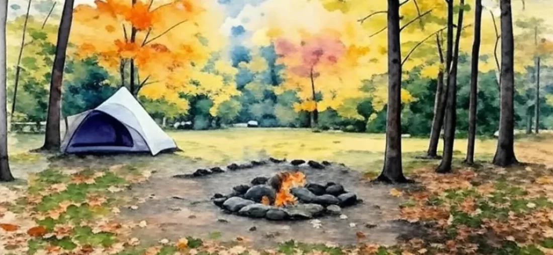
Camping options vary greatly along the entire buckeye. Some sections rely heavily on designated Buckeye Trail Association campsites (camping locations). These are often primitive, perhaps with a fire ring and maybe a pit toilet. Examples include Pretty Run in Hocking Hills and Buckhorn Ridge in Shawnee. You usually need to contact the BTA to check availability or make reservations for these specific camping facilities. Information can often be found on their website or through their trail guide materials. Other sections pass through Ohio State Parks like Caesar Creek, East Fork, or Burr Oak. These parks often have established campgrounds with more facilities, but you’ll need to book through the Ohio Department of Natural Resources (ODNR) official websites. Make sure you are on a secure websites (.gov) before entering payment information. Some areas may allow dispersed camping (following specific rules, especially in Wayne National Forest), while others might require using commercial campgrounds in trail towns. Always check the official BTA section maps (bt maps or printed maps) for the latest camping information and regulations for public lands. Reviewing the privacy policy of booking sites is also a good practice.
Water Sources and Treatment
Finding reliable water is critical. Sources include streams, springs, rivers, and lakes. But availability can change with the seasons or during dry spells, so consult recent trail alerts or hiker reports if possible. Always carry more water than you think you need, especially in summer or in drier sections. Consider potential swimming holes for cooling off during summer swimming season, but never rely on them as potable water sources without treatment. Never drink untreated water from natural sources. Bacteria, viruses, and parasites can make you very sick. You must carry a reliable water filter or purification method (like chemical tablets or UV treatment) and know how to use it. Even clear-looking water needs treatment.
Resupplying Food and Gear
Planning your food stops is essential, especially for longer sections covering multiple individual sections. Some parts of the trail pass through trail towns with grocery stores or convenience stores almost daily. Urban sections near Cleveland, Akron, or Cincinnati make resupply easy. However, other sections like Shawnee or parts of Wayne National Forest are very remote. You might need to carry food for several days between resupply points. Carefully study your BTA maps to identify potential trail towns and plan your mileage accordingly. Don’t count on finding backpacking-specific outfitters outside major cities. Pack repair kits for essential gear. Having backup food is always wise.
Getting To and From the Trail
Section hiking usually means you start and end in different places, unlike a circuit hike that starts and ends at the same point. This creates a transportation puzzle. Having two cars is often the easiest solution – park one at the end, drive the other to the start. If that’s not possible, arranging a ride with friends or family might work. Formal shuttle services specifically for the Buckeye Trail are rare. Sometimes BTA trail angels (volunteers who help hikers) might offer rides, but don’t rely on this without arranging it far in advance. Check the BTA website (official websites) or social media groups for potential contacts. Use the search search function on forums or the BTA site. Parking is available at many trailheads, but make sure it’s okay to leave a car overnight or for multiple days by checking local regulations or park rules, often found on gov websites.
When is the Best Time for Backpacking the Buckeye Trail?
You can hike the Buckeye Trail year-round, but each season has its pros and cons. Checking trail alerts on the BTA or relevant park official websites is wise before any trip. Weather can impact trail conditions significantly. Spring (March to May) brings wildflowers and budding trees. Temperatures are usually mild, often in the 40s to 60s F. But you should expect rain and potentially muddy trails, especially in lower areas or river valleys near the Ohio River. Summer (June to August) means long daylight hours. But you’ll face heat, high humidity, and bugs like ticks and mosquitoes. Afternoon thunderstorms are also common, so check forecasts frequently. Sections near lakes like Caesar Creek or rivers offer potential for summer swimming at designated spots. Fall (September to November) is a favorite for many hikers hiking ohio. Temperatures cool down to the 50s to 70s F. Ohio’s forests burst into stunning fall colors, especially in Hocking Hills and Shawnee State Forest (Wayne National Forest). Bugs decrease, but water sources might be lower, and rain is still possible. Winter (December to February) offers solitude and beautiful snow-covered landscapes. However, you must be prepared for sub-freezing temperatures, ice, and snow. Days are much shorter, and trail conditions can be very challenging; traction devices might be necessary. Some water sources may freeze, and access roads to trailheads could be impacted. Urban sections might be more accessible. Overall, late spring and early fall often provide the most comfortable balance of weather and trail conditions for Backpacking the Buckeye Trail. Careful planning allows for enjoyable hikes in any season. Remember conditions vary across Ohio from Lake Erie shores to the southern hills.
Gear You’ll Need for Your Adventure
Having the right gear makes your backpacking trip safer and more enjoyable. You don’t need the most expensive stuff, but it should be reliable. Focus on the “Big Three”: your backpack, shelter, and sleep system. Choose a backpack around 50-70 liters that fits you well and can comfortably carry your load. Your shelter could be a lightweight tent or a tarp, suitable for Ohio’s weather. Your sleeping bag or quilt should be rated for the expected nighttime temperatures (a 20-30°F bag is versatile for three-season hiking ohio). Layering your clothing is smart for managing temperature and moisture. Start with a moisture-wicking base layer (avoid cotton). Add an insulating mid-layer like fleece. Finish with a waterproof and windproof outer shell for rain and wind. Pack extra socks – dry feet are happy feet. Good footwear is vital. Broken-in hiking boots or sturdy trail running shoes work well for most Buckeye Trail terrain; choose based on personal preference and section difficulty. Use what feels comfortable for you over many miles. Don’t forget navigation tools. Carry the official BTA printed maps (bt maps) for your section, plus a compass. An overview map helps see the big picture, while detailed section map map views are crucial. A GPS device or smartphone app is a great backup, but don’t rely solely on electronics; know how to use your map and compass. You’ll need a way to cook, like a small backpacking stove, fuel, a pot, and a utensil. Store your food securely, especially at night, to protect it from animals. A bear bag or canister might be recommended or required in areas like Shawnee State Forest, check BTA trail alerts or Wayne National Forest regulations. Other essentials include a first-aid kit tailored to your needs and knowledge. Pack your water filter/purifier and know how to use it. A headlamp or flashlight with extra batteries, sun protection (hat, sunglasses, sunscreen), and insect repellent are necessary. Trekking poles can also help with stability and take stress off your knees, especially in hilly sections like Hocking Hills or Shawnee.
Staying Safe and Respectful on the Trail
Being prepared and aware helps lead to a safe trip. Keep an eye out for potential hazards. Poison ivy is common along Ohio trails; learn to identify its three-leaf clusters. Ticks are prevalent, especially in warmer months, carrying potential diseases. Check yourself thoroughly after hiking each day. Staying on cleared trails can minimize exposure. Wildlife like deer and turkeys are common sights. You might see snakes, but most are harmless; give them space and don’t provoke them. Black bears exist in eastern and southern Ohio, particularly the Shawnee section within Wayne National Forest. Make noise while hiking in bear country to avoid surprising them. Store your food properly away from your tent using a bear bag or canister as recommended. Never feed wildlife, intentionally or unintentionally. Always check the weather forecast before and during your hike via reliable sources, including official websites or weather apps. Ohio weather can change quickly. Be prepared for rain, wind, cold, or heat depending on the season and location. Hypothermia is a risk even in cool, wet conditions, while heat exhaustion can strike in summer. Understand the symptoms and how to respond. Proper clothing and hydration are vital preventative measures. Practice Leave No Trace principles rigorously. Pack out everything you pack in, including trash and food scraps. Stick to marked trails to protect surrounding vegetation and prevent erosion. Camp and build fires only in appropriate, durable locations, typically existing campsites or designated fire rings. Observe wildlife from a distance and respect their space. Be considerate of other hikers you meet on the trail ohio. Finally, always tell someone reliable where you are going and when you expect to be back. Give them your detailed itinerary, including your planned route and exit points. Check in with them when you finish your hike; this simple step is crucial for safety. Ensure they know who to contact (like local authorities or the county sheriff) if you are overdue and unreachable. Using secure websites or apps designed for location sharing might be an option, but check their privacy policy.
The People Behind the Trail: The Buckeye Trail Association
The Ohio’s Buckeye Trail wouldn’t exist without the Buckeye Trail Association (BTA). Founded in 1959, this non-profit organization is powered by dedicated volunteers. They build and maintain the trail, paint those blue blazes, create the official bt maps (printed maps and digital versions), and advocate for the trail’s protection. The BTA works tirelessly to keep the trail ohio open and accessible for everyone exploring the natural resources of Ohio. The BTA website belongs to this non-profit, distinct from an official government organization like the Ohio Department of Natural Resources. They provide valuable resources like trail alerts, section descriptions, and contact information. If you enjoy Backpacking the Buckeye Trail, consider supporting their efforts. You can become a member, volunteer for trail maintenance work days, or make a donation. Your help makes a real difference in preserving this Ohio treasure for future generations of hikers interested in hiking ohio. Check out the BTA official websites to learn more, find trail details, use the search search bar for information, and get involved with the trail association.
Conclusion of Backpacking the Buckeye Trail
Backpacking the Buckeye Trail, one section at a time, offers an amazing way to explore Ohio. From the shores of Lake Erie to the banks of the Ohio River, through cities and deep forests like the Wayne National Forest, this trail showcases the state’s incredible diversity. It connects various public lands including state parks, forests, and even a national park. It’s a journey that builds skills, creates memories, and connects you deeply with the Buckeye State’s landscape and history. The circular nature of the entire buckeye trail offers endless possibilities for exploration, whether you seek challenging circuit hikes in places like Burr Oak or quiet strolls along canals. Preparing properly using resources like BTA bt maps and trail alerts is part of the adventure. Use this trail guide to start planning your adventure on Ohio’s Buckeye Trail. Pick one of the individual sections, gather your gear, check official websites for current conditions, and get ready to hit the trail. Happy hiking.
