Comanche Peak Wilderness Area-Trails, Peaks and Fly Fishing
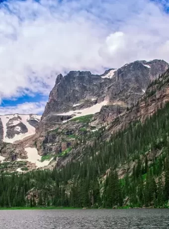
Nestled within the expansive Arapaho and Roosevelt National Forests, the Comanche Peak Wilderness Area offers a stunning escape for outdoor enthusiasts. This protected wilderness area covers over 66,000 acres of rugged terrain near Fort Collins, Colorado. It provides visitors a chance to connect with nature and experience the raw beauty of the Rocky Mountains.
If planning a trip to this breathtaking part of the rocky mountain region, prepare for adventure. From challenging hikes leading to alpine lakes to serene backcountry camping spots, the comanche peak wilderness has diverse offerings. Understanding what makes this area special helps you maximize your visit to this part of the roosevelt national forest.
Table of Contents
Hiking Trails in Comanche Peak Wilderness Area
The Comanche Peak Wilderness features an extensive network of trails,
welcoming hikers of various abilities. Exploring these paths is a primary way
visitors experience the area’s character. Remember to acquire good trail
maps before heading out, available from the Forest Service or local
outdoor retailers.
Proper preparation includes understanding trail difficulty, length, and elevation
gain. Many trails here involve significant climbs into high-altitude
environments. Always check conditions before you go, as weather can change
rapidly in the rocky mountain environment.
Emmaline Lake Trail
The Emmaline Lake Trail is a popular choice, covering approximately
12 miles round trip. This lake trail leads hikers to the picturesque Emmaline
Lake, cradled high amongst granite peaks. The journey involves creek
crossings and steady uphill sections, offering rewarding views along the way.
Considered moderately challenging, the trail ascends through forests before
opening into meadows like Cirque Meadow. Allow a full day for this hike
due to its length and the scenic distractions. Access is typically via the
Mummy Pass Trailhead, sometimes referred to as the Emmaline Lake Trailhead.
Comanche Peak Trail
For those seeking a more strenuous adventure, the trail to Comanche Peak
itself presents a significant challenge. This hike is roughly 16 miles round
trip and involves substantial elevation gain, reaching the summit at
over 12,700 feet. The rewards are sweeping panoramic views across the peaks
wilderness and into Rocky Mountain National Park.
This demanding route requires good fitness, navigation skills, and an early
start. The upper sections are often exposed and above treeline, demanding
preparedness for wind and changing weather. This is a true backcountry
experience within the national forests system.
Beaver Creek Trail
Offering a gentler experience, the Beaver Creek Trail provides a peaceful walk through forests and along the creek. It’s suitable for families or those looking for a less demanding day in the wilderness area. Wildlife sightings are common along this quieter path.
The trail explores lower elevation environments, showcasing different plant life than the high alpine routes. It’s a good option for shorter trips or when acclimatizing to the altitude. Check with the Canyon Lakes Ranger District for specific mileage and access points.
Stormy Peaks Trail
Accessible from the Stormy Peaks Trailhead, this trail offers another route into the high country. The Stormy Peaks area provides access to several destinations, including connections toward Signal Mountain. This trail typically involves steep sections as it climbs away from the trailhead.
Hikers can tailor their trip length, from shorter jaunts to longer backpacking loops connecting with other trails. The peaks trailhead itself can be busy, so arriving early is often a good idea. This area exemplifies the rugged nature of the Comanche Peak Wilderness.
Dunraven Trailhead Access
The Dunraven Trailhead serves as a key access point on the northern side of the wilderness. Several trails originate here, offering routes towards the Cache La Poudre River corridor and deeper into the national forest. It provides options for both day hikes and multi-day backpacking adventures.
From Dunraven, hikers can explore areas less frequented than those closer to Estes Park or Rocky Mountain National Park. Trail conditions can vary, so consulting recent reports or the ranger district is helpful. This trailhead offers a gateway to the wild heart of the Roosevelt national forest lands.
Cow Creek Trail
The Cow Creek drainage offers additional hiking opportunities, often accessed from trailheads slightly outside the main wilderness boundary or via connecting routes. This area can provide solitude and chances to explore different aspects of the wilderness area landscape. Trails here might follow the creek or climb onto adjacent ridges.
Remember that any trail entering the designated Comanche Peak Wilderness requires adherence to wilderness regulations. The Cow Creek area can sometimes be used for trail riding as well, subject to specific rules. Always yield to horses on shared trails.
West Creek Falls
Best Fly Fishing Lakes in and Near Comanche Peak Wilderness
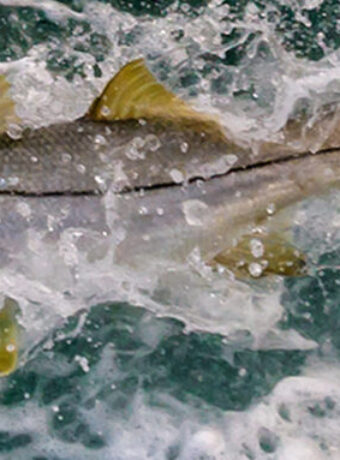
For anglers, the Comanche Peak Wilderness Area and nearby sections of Rocky Mountain National Park offer some of the best fly fishing lakes in Colorado. These pristine alpine waters are home to trout species like cutthroat, brook, and rainbow, providing a rewarding experience for fly fishers. Below, we highlight three top lakes accessible from trails near McGraw Ranch, along with recommended fly patterns to maximize your success.
Emmaline Lake
· Location: Comanche Peak Wilderness, accessible via a 5.5-mile hike from the Emmaline Lake Trailhead near Pingree Park (a short drive from McGraw Ranch).
· Fish Species: Greenback cutthroat trout, brook trout.
· Why It’s Great: Nestled at 11,000 feet, Emmaline Lake is a crystal-clear alpine gem surrounded by dramatic peaks. Its remote location ensures solitude and healthy fish populations. The lake’s shallow edges and deeper pockets make it ideal for sight fishing.
· Fly Patterns:
o Dry Flies: Parachute Adams (#16-18) for versatile surface action; Elk Hair Caddis (#14-16) in tan or olive for evening hatches.
o Nymphs: Pheasant Tail Nymph (#16-20) for subsurface feeding; Zebra Midge (#18-22) in black or red for deep pockets.
o Streamers: Small Woolly Buggers (#10-12) in olive or black for aggressive brook trout.
· Tips: Fish early morning or late afternoon when trout are active. Focus on the inlet and outlet streams for feeding fish. Use light tippet (5X-6X) for wary cutthroats.
Browns Lake
· Location: Comanche Peak Wilderness, reached via a 10.6-mile round trip hike from the Beaver Creek Trailhead (accessible from McGraw Ranch area).
· Fish Species: Brook trout, cutthroat trout.
· Why It’s Great: Browns Lake is a serene, high-altitude lake known for its eager brook trout and occasional cutthroats. The surrounding meadows and rocky shores provide easy casting access, and the lake’s clarity makes it perfect for spotting cruising fish.
· Fly Patterns:
o Dry Flies: Royal Wulff (#14-16) for its visibility and effectiveness; Griffith’s Gnat (#18-20) for midge hatches.
o Nymphs: Hare’s Ear Nymph (#16-18) for a natural look; Copper John (#16-20) in red or green for added flash.
o Streamers: Muddler Minnow (#10-12) in natural colors for deeper waters.
· Tips: Cast near submerged logs or rocky drop-offs where trout hide. A slow retrieve with nymphs or streamers works well in cooler months. Check for seasonal fishing regulations.
Comanche Reservoir
· Location: Comanche Peak Wilderness, accessible via a longer hike (part of the 30-mile Stormy Peaks loop or shorter routes from nearby trailheads).
· Fish Species: Rainbow trout, cutthroat trout.
· Why It’s Great: This reservoir offers a larger fishing area with deeper waters, ideal for anglers seeking bigger trout. Its scenic backdrop and diverse structure—rocky shores, inlets, and open water—make it a versatile spot for fly fishing.
· Fly Patterns:
o Dry Flies: Blue-Winged Olive (#16-18) for cloudy days; Stimulator (#12-14) in yellow or orange for aggressive takes.
o Nymphs: Prince Nymph (#14-18) for its flash and weight; San Juan Worm (#12-14) in pink or red for post-rain conditions.
o Streamers: Zonker (#8-10) in white or olive for targeting larger rainbows in deep water.
· Tips: Use a floating line with a long leader for dry flies. Fish the windward side of the lake where insects collect. Be prepared for windy conditions at higher elevations.
Fly Fishing Tips for the Comanche Peaks Wilderness
· Season: June to September is prime, with peak hatches in July and August. Early fall brings vibrant colors and active fish.
· Gear: A 3-6 weight fly rod (8.5-9 feet) is ideal for these lakes. Bring a variety of tippets (4X-6X) and a small fly box with the patterns above.
· Regulations: Check Colorado Parks and Wildlife rules—some areas require catch-and-release, and a valid fishing license is mandatory.
· Ethics: Practice Leave No Trace by packing out all gear and avoiding trampling fragile shorelines.
Camping in Comanche Peak Wilderness Area
Camping within the Comanche Peak Wilderness Area allows for deep immersion in the natural setting. Dispersed camping is the primary method, permitted throughout most of the area away from developed sites. This means selecting your own campsite following specific guidelines.
No permits are required for standard overnight stays for small groups, but adhering to Leave No Trace principles is mandatory. This helps protect the fragile environment for future visitors. Always pack out everything you pack in, including trash and food waste.
Popular dispersed camping zones include areas near Comanche Reservoir (though access may vary) and along segments of the Poudre River that border the wilderness. When selecting a site, choose durable surfaces like rock or bare ground. Camp at least 200 feet away from lakes, streams, and trails to minimize impact and protect water quality.
Fire regulations are critical; check current restrictions with the Forest Service before your trip, as bans are common during dry periods. Campfires, when permitted, should be small and contained within existing fire rings if available, or use a fire pan. Ensure any fire is completely extinguished – cold to the touch – before leaving.
Consider using a backpacking stove for cooking, as it has less impact than a campfire. Proper food storage is also essential to prevent attracting wildlife like bears and smaller critters. Using bear canisters or employing proper hanging techniques is often required or strongly recommended.
While there isn’t a designated group campground directly within the wilderness boundaries, some Forest Service campgrounds may be available nearby in the broader Roosevelt National Forest. Check the official recreation websites for options if you prefer a more structured camping experience outside the wilderness itself. Some trailheads may have a picnic table for day use.
Wildlife and Nature
The Comanche Peak Wilderness Area teems with a diverse array of Rocky Mountain wildlife. Patient observers might spot large mammals like elk and mule deer, particularly during dawn and dusk hours in meadows and forest edges. Bighorn sheep may occasionally be seen navigating rocky slopes.
Predators also inhabit the area, including black bears and elusive mountain lion populations. While encounters are rare, it’s vital to be aware of their presence. Store food securely, make noise while hiking to avoid surprising animals, and carry bear spray, knowing how to use it effectively.
Birdwatchers can find numerous species, from Steller’s jays and Clark’s nutcrackers in the forests to golden eagles soaring above the peaks. The riparian areas along creeks and the Cache la Poudre River attract various birds and smaller mammals. Remember to observe all wildlife from a safe distance and never feed them.
The flora of the Comanche Peak Wilderness is equally impressive, changing with elevation. Lower slopes feature montane forests of ponderosa pine and Douglas fir, transitioning to lodgepole pine, spruce, and fir at higher elevations. Wildflower displays peak in July and August, with species like columbine, Indian paintbrush, gentian, and alpine sunflowers adding color to meadows and tundra.
Alpine tundra environments exist above treeline, characterized by hardy, low-growing plants adapted to harsh conditions. These areas are particularly fragile; stay on trails to avoid damaging delicate vegetation. The diverse ecosystems reflect the dramatic elevation changes within the rocky mountains.
Fishing is possible in some of the alpine lakes and streams, including parts of the la poudre river. Anglers should possess a valid Colorado fishing license and be familiar with state regulations. High-altitude lakes may contain various trout species.
Access and Location
The Comanche Peak Wilderness Area is located in northern Colorado, primarily within the Canyon Lakes Ranger District of the Arapaho and Roosevelt National Forests. It lies west of Fort Collins and northwest of Estes Park. Access involves driving mountain roads, some of which may be unpaved.
Primary access points and trailheads include Mummy Pass (Emmaline Lake Trailhead), Stormy Peaks Trailhead, Pingree Park (CSU Mountain Campus area, requires coordination), and Dunraven Trailhead. Check road conditions before departing, especially for higher elevation trailheads early or late in the season. Some access roads may require high-clearance vehicles.
From Fort Collins, drivers typically head west on Highway 14 along the Cache la Poudre River Scenic Byway or south towards the Estes Park area depending on the desired trailhead. Travel times can vary significantly based on road conditions and specific destinations. Always carry a physical map of the national forest and wilderness area.
Parking at popular trailheads like Stormy Peaks Trailhead or the Emmaline Lake Trailhead (lake trailhead) can fill quickly, especially on weekends. Arriving early is recommended. Be sure to park only in designated areas and avoid blocking roads or gates.
The wilderness shares a boundary with Rocky Mountain National Park to the south. While adjacent, management and regulations differ between the wilderness area and the national park. Understanding the wilderness boundary is important if your route potentially crosses
Other Activities
Beyond hiking and backpacking, the Comanche Peak Wilderness Area supports other forms of recreation. Trail riding on horseback is permitted on many trails, offering a different way to experience the landscape. Check specific trail designations, as some may be closed to stock use.
Photography enthusiasts will find endless inspiration, from grand mountain vistas and alpine lakes to delicate wildflowers and potential wildlife encounters. The changing light during sunrise and sunset can create spectacular scenes. Remember to protect your gear from the elements.
While less common than summer use, winter recreation is possible, primarily snowshoeing and cross-country skiing on lower elevation trails when conditions allow. Avalanche awareness and safety precautions are critical for any winter travel in the backcountry. Access can be limited due to seasonal road closures.
Fishing, as mentioned earlier, is another activity enjoyed by some visitors in the area’s lakes and streams. Be prepared for backcountry fishing conditions and follow all regulations. The remote nature of many fishing spots adds to the appeal.
Exploring the history of the area can also be part of a visit. Remnants of an old wagon road might be visible in certain sections, hinting at past human use. Additionally, there is a known plane crash site within the wilderness; visitors should treat such sites with respect if encountered.
Planning and Regulations
Careful planning is essential for a safe and enjoyable trip into the Comanche Peak Wilderness. Check the weather forecast immediately before your trip, but always be prepared for sudden changes, including thunderstorms, wind, snow (even in summer at high elevations), and temperature drops. Pack layers of clothing, rain gear, and sun protection.
Altitude sickness can affect anyone, regardless of fitness level. Acclimatize gradually if coming from lower elevations. Stay hydrated, avoid overexertion initially, and be aware of symptoms like headache, nausea, and fatigue. Descend if symptoms worsen.
Carry adequate water or a reliable water filter/purification method, as surface water sources may contain bacteria or Giardia. Navigation tools are crucial; bring a map and compass and know how to use them, even if you have a GPS device. Cell service is unreliable or nonexistent in most of the wilderness area.
Wilderness regulations are in place to protect the environment and the visitor experience. Group size is limited (typically 12 people and/or 15 head of stock), motorized equipment is prohibited, anddrone use is not allowed. Familiarize yourself with all rules before entering the wilderness boundary.
Leave No Trace principles are the standard for responsible wilderness travel:
- Plan ahead and prepare.
- Travel and camp on durable surfaces.
- Dispose of waste properly (pack it in, pack it out).
- Leave what you find.
- Minimize campfire impacts (use stoves, check fire bans).
- Respect wildlife (observe from distance, store food properly).
- Be considerate of other visitors.
For the most current information on conditions, regulations, trail closures, and fire restrictions, consult the official website of the Arapaho and Roosevelt National Forests. Look for contact information for the Canyon Lakes Ranger District. Remember that a gov website belongs to an official government organization.
Be aware of safety protocols. Let someone know your itinerary and expected return time. Carry a first-aid kit.
Best Time to Visit
The prime season for visiting the Comanche Peak Wilderness Area is typically from late June through early September. During this period, most trails become snow-free, especially at higher elevations, and daytime temperatures are generally pleasant. Wildflowers are usually at their peak in July and August.
Be aware that afternoon thunderstorms are common during the summer months, particularly in July and August. Plan hikes to be off exposed ridges and summits by early afternoon. Always check the weather forecast before and during your trip.
Visiting outside the peak season is possible but requires more preparation. Snow can linger on high-elevation trails well into July and may return as early as September. Roads accessing some trailheads may close seasonally. Always check current conditions with the Forest Service before venturing out in the shoulder seasons or winter.
Nearby Attractions
If you have extra time, several noteworthy attractions are located near the Comanche Peak Wilderness Area.
Rocky Mountain National Park
Adjacent to the south, Rocky Mountain National Park offers world-renowned mountain scenery, abundant wildlife viewing, and hundreds of miles of additional hiking trails. This mountain national park provides paved scenic drives like Trail Ridge Road (seasonally open) and numerous visitor centers. Note that timed entry reservations may be required to enter the national park during peak season.
Comparing the wilderness area experience to the mountain national park highlights differences in management and visitor density. The Comanche Peak Wilderness generally offers more solitude than its famous neighbor, Rocky Mountain National. Both protect vital parts of the rocky mountain ecosystem.
Fort Collins
The city of Fort Collins lies to the east and serves as a major gateway to the region. Known for its vibrant Old Town, numerous craft breweries, and outdoor culture, it’s an excellent base for supplies or relaxation before or after your wilderness trip. Colorado State University is also located here.
Fort Collins offers lodging, dining, gear shops, and cultural attractions. It provides amenities often sought after a backcountry adventure. The proximity makes accessing the Roosevelt National Forest and Comanche Peak Wilderness convenient for many visitors.
Indian Peaks Wilderness
South of Rocky Mountain National Park lies the Indian Peaks Wilderness. Similar in character to Comanche Peak, the Indian Peaks offer stunning alpine scenery, numerous lakes, and challenging trails. It’s another excellent option for backpacking and hiking in the rocky mountain region, managed jointly by the Forest Service and requiring permits for overnight stays in some zones.
Conclusion of Comanche Peak Wilderness Area
The Comanche Peak Wilderness Area provides a genuine escape into the wild landscapes of the Colorado Rocky Mountains. Whether you challenge yourself on the trail to Comanche Peak, hike the beautiful Emmaline Lake Trail, camp beneath starlit skies near Cirque Meadow, or enjoy trail riding through forested paths, this part of the Roosevelt National Forest offers memorable experiences.
Remember to plan carefully, prepare for mountain conditions, and practice Leave No Trace ethics to protect this special place. Respect the wilderness boundary and regulations set forth by the Forest Service. Enjoy the solitude, the scenery, and the diverse nature found within the Comanche Peak Wilderness and the surrounding national forests.
