Exploring the Vast Beauty of Sequoia-Kings Canyon Wilderness
Thinking about visiting the staggering beauty of the Sierra Nevada? You’ve likely heard whispers, maybe seen photos, of towering trees and canyons that plunge deeper than you can imagine. This place, the Sequoia-Kings Canyon Wilderness, calls to adventurers, nature lovers, and anyone needing a break from the everyday hustle.
It’s a land of giants, both in trees and mountains. Planning a trip here yourself, maybe hiking, camping, or casting a line? You’re in the right spot.
We’re going to walk through everything you need to know to plan an unforgettable journey into this expansive canyon wilderness.
Table of Contents

Text content
A Little History Shapes the Trails
Knowing the story behind this land helps you appreciate every step you take. This isn’t just pretty scenery; it’s shaped by time, nature, and people. Understanding its past deepens your connection to the place.
How the Mountains and Trees Got Here
Millions of years ago, massive geological forces pushed the Sierra Nevada mountains skyward. Much later, glaciers came, carving out the dramatic landscape we see today. They sculpted Kings Canyon, making it one of North America’s deepest, and left behind pockets that became sparkling alpine lakes like Rae Lakes.
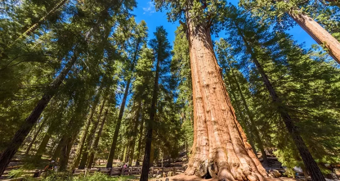
And the stars of the show, the giant sequoia trees? These trees are ancient, with some living for over 3,000 years. They found perfect growing conditions in the specific microclimates here, becoming living monuments to the area’s long history.
Native American Presence
Long before it was part of the national park system, this wilderness was home. It’s the ancestral land of the Mono/Monache, Paiute, Tübatulabal, and Yokuts peoples. They lived here for thousands of years, creating paths for trade, hunting, and moving with the seasons.
Many wilderness trails hikers use today follow these old routes. These native communities knew how to live with the land, even using fire wisely to help the sequoia groves thrive, a practice the park service studies today through careful land management.
Saving a Special Place
In the 1800s, explorers like John Muir saw how special this area was. He wrote passionately about its beauty, pushing for its protection. Thanks to efforts like his, Sequoia National Park was created in 1890 – the second of the US national parks.
Kings Canyon National Park joined later, in 1940, forming the jointly managed Sequoia-Kings Canyon complex people visit today. Then, the Wilderness Act of 1964 established the framework for wilderness preservation. Over 97% of these parks became designated wilderness, including the adjacent John Krebs Wilderness (formerly part of the park’s potential wilderness additions).
This designation preserved more than 800 miles of trails and the vast ecosystems they cross, forming a large part of the National Wilderness Preservation System. This commitment to national wilderness protection safeguards these lands for future generations.
Building the Trails We Hike
The trails didn’t just appear. They started as native paths, then were expanded by settlers and loggers. Later, the National Park Service (NPS) stepped in, developing routes like the High Sierra Trail in the 1930s.
Iconic long-distance trails like the John Muir Trail (JMT) and Pacific Crest Trail (PCT) were finished in the 20th century, parts of which traverse this parks wilderness. They now draw hikers from all over the world, connecting key points across this massive wilderness area. Finding trail descriptions is easy on the park website or at visitor centers.
Best Hikes for Every Walker
With hundreds of miles of trails, picking a hike can feel overwhelming. Don’t worry, I’ve got you covered. Here are some top choices, from easy walks among giants to climbs that will test your legs and reward you with stunning views within these national parks.
Congress Trail (Sequoia National Park)
This is a classic, perfect for almost everyone visiting Sequoia National Park. It’s a paved 2-mile loop starting near the Giant Forest Museum. The main attraction? The General Sherman Tree, the biggest tree on Earth by volume, an iconic giant sequoia.
The trail is easy to walk and includes interpretive signs explaining the lives of these massive sequoias, like the nearby General Grant tree in Grant Grove. You’ll wander through groves named the Senate and House. Because it’s accessible, expect company, especially mid-day in summer, but seeing the Sherman Tree is worth it.
- Distance: 2 miles (loop)
- Difficulty: Easy
- Elevation Gain: 200 feet
- Best Time: Spring and fall offer pleasant weather and fewer people.
Mist Falls Trail (Kings Canyon National Park)
Ready for something a bit longer in Kings Canyon National Park? This 7.8-mile out-and-back trail follows the South Fork of the Kings River. It starts at Roads End, deep within the Cedar Grove area of Kings Canyon.
The path takes you through forests and meadows with granite cliffs towering above. Your reward is Mist Falls, a beautiful 100-foot cascade that feels amazing on a warm day. This trail is also the start of the famous Rae Lakes Loop backpack, a major destination within the canyon wilderness.
- Distance: 7.8 miles (out-and-back)
- Difficulty: Moderate
- Elevation Gain: 600 feet
- Best Time: Late spring through early fall is best, after the snow melts.
Tokopah Falls Trail (Sequoia National Park)
Starting near the busy Lodgepole Campground in sequoia national, this 3.8-mile trail feels surprisingly wild. It follows the Marble Fork of the Kaweah River. You’ll pass through meadows and cross small streams.
The destination is Tokopah Falls, an impressive 1,200-foot cascade tumbling down a granite cliff face. It’s a great moderate hike, popular with families staying at the campground. In summer, look for spots along the river to cool your feet.
- Distance: 3.8 miles (out-and-back)
- Difficulty: Moderate
- Elevation Gain: 600 feet
- Best Time: Spring for the best waterfall views, summer for warmer temps.
Text content

Hydrophobic Brook Trout Quarter Zip Heavy Weight Graphic Hoodie
Little Baldy Trail (Sequoia National Park)
Want big views without a killer climb? Little Baldy is your answer. This 3.3-mile hike gains about 700 feet to a granite dome overlook within Sequoia National Park.
From the top, you get amazing 360-degree views of the surrounding Sierra Nevada peaks. It’s a fantastic spot for photos, especially near sunset. Keep an eye out for chubby marmots sunning themselves on the rocks.
- Distance: 3.3 miles (out-and-back)
- Difficulty: Moderate
- Elevation Gain: 700 feet
- Best Time: Spring through fall.
Alta Peak Trail (Sequoia National Park)
Okay, experienced hikers, this one’s for you. The climb to Alta Peak is tough but incredibly rewarding. It’s nearly 14 miles round trip with about 4,000 feet of elevation gain, reaching 11,204 feet.
The trail starts at Wolverton and climbs steadily through forests and meadows. The final push is above the tree line, offering panoramic views that include the Great Western Divide. Make sure you’re ready for the altitude and potential for afternoon thunderstorms.
- Distance: 13.8 miles (out-and-back)
- Difficulty: Strenuous
- Elevation Gain: 4,000 feet
- Best Time: Summer to early fall, once the snow is gone.
Zumwalt Meadow Trail (Kings Canyon National Park)
Down in the Cedar Grove section of Kings Canyon National Park, this easy 1.5-mile loop is a must-do. It showcases the dramatic scenery of the canyon floor. You get towering granite walls, a peaceful meadow, and the flowing Kings River.
It’s mostly flat and great for families or a relaxing stroll. The contrast between the green meadow and the sheer grey cliffs is stunning. It’s a perfect spot for photos and maybe spotting some deer.
- Distance: 1.5 miles (loop)
- Difficulty: Easy
- Elevation Gain: 100 feet
- Best Time: Spring through fall.
Where to Camp Under the Stars
Sleeping out in Sequoia-Kings Canyon is magical. You can choose developed campgrounds with more comforts or head into the backcountry for true solitude. Here are some top spots for camping in these national parks.
Developed Campgrounds
These campgrounds usually have sites you can reserve, plus amenities like restrooms and water. Check Recreation.gov for reservations, as they fill quickly, especially around holidays like Memorial Day.
Lodgepole Campground (Sequoia NP)
This is a big, popular campground right near the Giant Forest area of Sequoia National Park. It’s got flush toilets, showers, and even a nearby market and visitor center. Its location makes it a great base for exploring the giant sequoia trees and hitting trails like Tokopah Falls.
Azalea Campground (Kings Canyon NP)
Located near Grant Grove in Kings Canyon National Park, Azalea feels a bit quieter than Lodgepole. It’s close to the General Grant Tree and trails in the Grant Grove area. It offers flush toilets but no showers, and has its own visitor center nearby.
One big plus? It’s often open year-round, though services are limited in winter. During peak season, reservations are smart, but it sometimes has first-come, first-served spots too.
Cold Springs Campground (Sequoia NP – Mineral King)
If you want a more remote drive-in camping experience, head to Mineral King Valley within Sequoia National Park. Cold Springs is a smaller campground (40 sites) nestled in this high-elevation valley. It’s near trailheads for challenging hikes like Franklin Lakes and provides access to rugged wilderness areas.
There are vault toilets and required bear boxes for food storage, but no running water, so bring your own or a filter. The steep, narrow road to Mineral King is slow and winding, usually open only from late May/June to October, weather permitting. Sites are first-come, first-served.
Backcountry Camping
Ready to leave the car behind? Backpacking opens up a whole world of camping spots within the Sequoia-Kings Canyon Wilderness. You’ll need a wilderness permit and proper gear, including a bear canister for food storage, adhering to minimum impact principles.
Redwood Canyon (Kings Canyon NP)
Imagine camping among giant sequoias, far from any crowds. That’s Redwood Canyon, accessible via Kings Canyon National Park. You hike in a few miles to find dispersed sites in one of the largest sequoia groves.
It feels peaceful and ancient here. You need a wilderness permit, which you can try to get online or potentially as a walk-up at a wilderness office. Remember your required bear canister for all food and scented items.
Rae Lakes (Kings Canyon NP)
Camping at Rae Lakes is a highlight for many backpackers doing the Rae Lakes Loop in Kings Canyon National Park. These stunning alpine lakes sit below dramatic peaks within the designated wilderness. Designated camping areas have bear boxes, making food storage easier.
Fishing here is popular, and the scenery is world-class. Permits for the Rae Lakes Loop are very competitive, so plan way ahead for this part of the canyon national park.
Bearpaw High Sierra Camp (Sequoia NP – Note: Status Uncertain)
This spot offered a different kind of backcountry experience. Located 11.5 miles in on the High Sierra Trail in Sequoia National Park, it had tent cabins and even served meals. It offered amazing views without needing to carry full camping gear.
However, the camp suffered damage and has been closed for repairs since 2023. Check the park’s website via the national park service for the latest status if you hope to stay here in the future. Reservations, when open, were needed far in advance.
Epic Backpacking Adventures
For a deep immersion into the wilderness, nothing beats a multi-day backpacking trip. You get solitude, stunning scenery, and a real sense of accomplishment. Here are some of the best backpacking routes in the Sequoia-Kings Canyon Wilderness.
Rae Lakes Loop (Kings Canyon NP)
This is arguably the most famous loop in the Sierra Nevada. Around 41 miles, it typically takes 3-5 days within Kings Canyon National Park. You climb over Glen Pass (almost 12,000 feet.), wander through gorgeous meadows like Paradise Valley, and circle the spectacular Rae Lakes basin.
It’s a challenging but incredibly rewarding trip into the canyon wilderness. The combination of high passes, pristine lakes, and well-maintained wilderness trails makes it popular. Getting a wilderness permit requires planning and often some luck in the lottery system via Recreation.gov.
- Distance: ~41 miles (loop)
- Duration: 3-5 days
- Difficulty: Moderate to strenuous
- Highlights: Glen Pass views, Rae Lakes swimming/fishing, varied scenery.
High Sierra Trail (Sequoia NP)
Want a truly epic adventure across Sequoia National Park? The High Sierra Trail spans about 72 miles across the park, from Crescent Meadow all the way to the summit of Mount Whitney, the highest peak in the lower 48 states. This is a serious undertaking, usually taking 6-8 days one way.
You’ll pass through giant sequoia groves, soak in Kern Hot Springs, hike the deep Kern River Canyon, and tackle multiple high passes. Logistics are important, as you need to arrange transportation from Whitney Portal back to the start. Wilderness permits are very competitive for this classic route, often connecting with parts of the John Muir Trail (J Muir Trail).
- Distance: ~72 miles (one-way)
- Duration: 6-8 days
- Difficulty: Strenuous
- Highlights: Crossing the Sierra, Kern Hot Springs, summiting Mt. Whitney.
Lakes Trail to Pear Lake (Sequoia NP)
Looking for a shorter, introductory backpacking trip in Sequoia National Park? The Lakes Trail is fantastic. Hiking to Pear Lake is about 12 miles round trip, easily done in a weekend (1-2 nights).
Starting at Wolverton, you climb past several beautiful alpine lakes – Heather, Emerald, Aster – before reaching Pear Lake. There are designated campsites with bear boxes, making food storage simple. It’s a great taste of Sierra Nevada backpacking without the huge mileage or passes.
- Distance: ~12 miles (out-and-back)
- Duration: 1-2 nights
- Difficulty: Moderate
- Highlights: String of alpine lakes, Watchtower views, good intro trip.
Big Five Lakes Loop (Sequoia NP)
This strenuous 30-mile loop offers solitude and stunning alpine scenery in the Mineral King section of Sequoia National Park. Starting from Mineral King, you hike through timberline forests into granite basins dotted with five sapphire-blue lakes. It’s less crowded than Rae Lakes but equally beautiful within the wilderness areas.
You’ll cross high passes and possibly encounter lingering snow early in the season. It requires good navigation skills and fitness. A wilderness permit is needed, usually obtained through the Mineral King lottery or walk-up process at the local wilderness office.
- Distance: ~30 miles (loop)
- Duration: 3-4 days
- Difficulty: Strenuous
- Highlights: Beautiful remote lakes, solitude, challenging passes.
Mineral King Loop (Sequoia NP)
This challenging loop, roughly 45 miles, explores the rugged terrain around Mineral King Valley in Sequoia National Park. It often includes passes like Sawtooth Pass and Timber Gap, offering spectacular views and wildflower displays in summer. This area feels more remote and wild than others, bordering national forests.
Wilderness permits are needed, and the trail conditions can be demanding. Expect steep climbs and descents. This is a route for experienced backpackers seeking adventure off the main corridors of the sequoia-kings canyon wilderness.
- Distance: ~45 miles (loop)
- Duration: 4-6 days
- Difficulty: Strenuous
- Highlights: Remote feel, wildflowers, challenging terrain, Franklin Lakes.
Top Spots for Fly Fishing Bliss
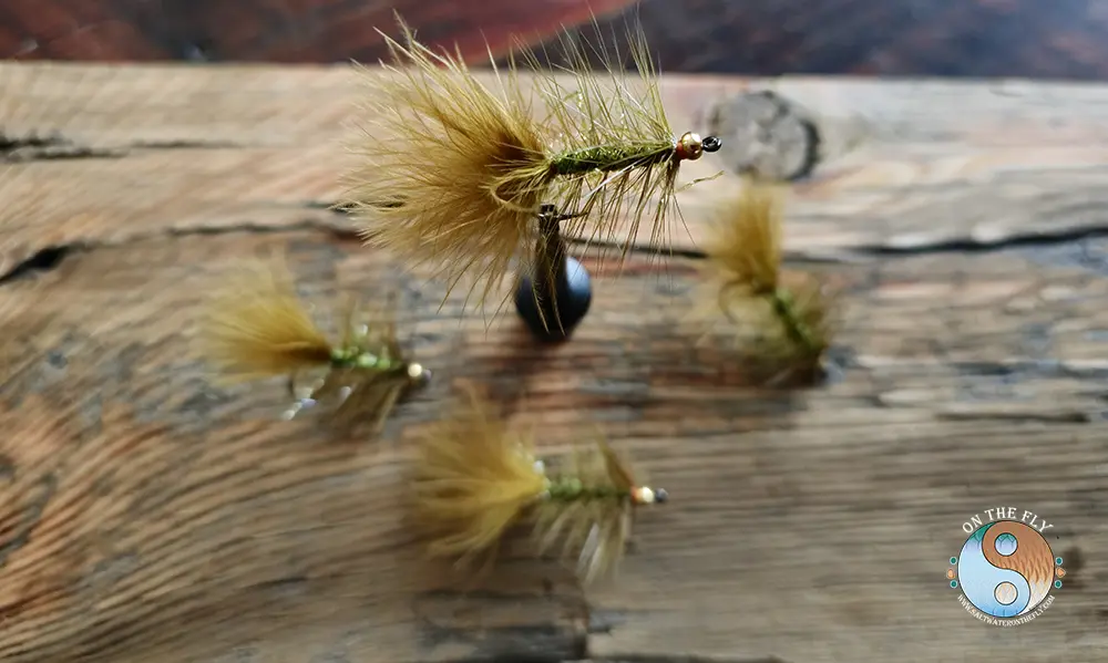
The clear, cold waters of the Sequoia-Kings Canyon Wilderness are a fly fisher’s dream. Home to rainbow, brook, brown, and the iconic golden trout (California’s state fish.), there are plenty of opportunities across these national parks. Remember you’ll need a California fishing license.
Here are six top spots to try your luck:
Rae Lakes (Kings Canyon NP):
Accessible via backpacking the Rae Lakes Loop in Kings Canyon National Park. These high-altitude lakes are famous for their gorgeous golden and rainbow trout. Fishing from shore or wading near inlets can be productive, especially mid-summer.

Text content

-
Kern River (Sequoia NP):
-
Deep in the backcountry along the High Sierra Trail lies the Kern River in Sequoia National Park. It’s known for potentially large, wild golden and brown trout in its deep pools. Getting here takes effort, making it a true wilderness fishing experience.
-
South Fork Kings River (Kings Canyon NP):
-
You can reach parts of this river with a moderate day hike from Roads End (Mist Falls Trail) or on a shorter backpack into Paradise Valley within Kings Canyon National Park. It holds healthy populations of rainbow and brook trout in classic river pocket water and pools.
-
Kaweah River (Sequoia NP):
-
Particularly the Middle Fork near Lodgepole in Sequoia National Park. Some sections are accessible via day hikes, offering chances for rainbow and brown trout. Early season (late spring/early summer) is often best before water levels drop significantly.
-
Pear Lake (Sequoia NP):
-
Reached via the Lakes Trail backpack in Sequoia National Park. This beautiful alpine lake is home to golden trout. Fishing here combines stunning scenery with the thrill of catching California’s state fish.
-
Franklin Lakes (Sequoia NP – Mineral King):
-
A strenuous day hike or short backpack from the Mineral King trailhead leads to these two lakes in Sequoia National Park. They offer good fishing for golden trout, often with less pressure than other famous spots because they are harder to reach.
Planning Your Own Sequoia-Kings Canyon Wilderness Adventure
Okay, ready to make this trip happen? Planning a DIY trip takes some work, but it’s totally worth it for an adventure in the sequoia-kings canyon wilderness. Here’s a step-by-step guide to get you started exploring this part of the Sierra Nevada.
1. Decide When and What
First, figure out what you want to do and the best time to go. Hiking among giant sequoia trees? Spring and fall have fewer crowds and milder temperatures. High-altitude backpacking or fishing? July through September usually means snow-free trails and more accessible passes.
Always check current conditions before you go, paying attention to potential road construction delays. The National Park Service website for Sequoia & Kings Canyon is your best resource for alerts on weather, trails, road closures (like the winter closure of the road to Cedar Grove), and fire restrictions. Recent years have seen impacts from fires and floods, so checking is critical for safety and access.
Consider visiting attractions like Crystal Cave (requires separate tickets) or spending time exploring different areas like Grant Grove, Giant Forest, Cedar Grove, or Mineral King. Each offers a different experience within the larger Sequoia-Kings Canyon complex.
2. Get Your Permits Sorted
This is very important. Day hiking generally doesn’t need a permit, but park entrance fees apply. But for any overnight backcountry camping in the designated wilderness, you absolutely need a wilderness permit.
For popular trails during peak season (roughly late May/Memorial Day weekend to late September), there are quotas to manage visitor numbers and protect the environment. You apply for wilderness permits months in advance via Recreation.gov, often through a lottery system for high-demand trailheads like Rae Lakes or the High Sierra Trail starting point for Mount Whitney.
Some permits might be available as walk-ups (first-come, first-served) 24 hours before your trip starts at specific visitor centers or wilderness offices. However, don’t rely on this for popular routes or peak times. Developed campground reservations are also made on Recreation.gov, and that California fishing license is mandatory if you plan to fish.
3. Map Your Route
Know where you’re going. Get good maps – paper maps and a compass are essential and should always be carried (don’t rely only on your phone). The Sequoia Parks Conservancy sells detailed topographic maps at visitor centers, or use reliable apps like AllTrails+ for downloadable offline maps as a backup.
Carefully consider your starting point (trailhead), daily mileage, elevation gain, water sources, and potential campsites based on trail descriptions. Be realistic about your fitness level and experience. Remember that hiking at altitude is much harder than at sea level, affecting even experienced hikers.
4. Gear Up
Pack the Ten Essentials – navigation, sun protection, insulation, illumination, first-aid, fire starter, repair kit, nutrition, hydration (plus filter.), and emergency shelter. Your specific gear depends on your activity (day hike vs. backpack), the season, and the elevation you plan to reach. Even summer afternoons can bring thunderstorms.
For backpacking, you’ll need a tent, sleeping bag, sleeping pad, stove, and critically, an approved bear-resistant food storage container (bear canister) for all food, trash, and scented items like toiletries. Proper food storage is mandatory in most areas. You can often rent bear canisters from visitor centers or outdoor shops near the park entrances.
| Essential Gear Category | Examples |
|---|---|
| Navigation | Map, Compass, GPS/Phone App (offline) |
| Sun Protection | Sunscreen, Hat, Sunglasses |
| Insulation | Layers (fleece, puffy jacket), Rain Gear |
| Illumination | Headlamp/Flashlight + Extra Batteries |
| First-Aid | Comprehensive Kit |
| Fire | Lighter, Matches (waterproof), Fire Starter (check fire restrictions) |
| Repair Kit | Duct Tape, Knife/Multi-tool, Cordage |
| Nutrition | Extra Day’s Worth of Food |
| Hydration | Water Bottles/Bladder + Filter/Purifier |
| Shelter | Tent/Tarp (for overnights), Emergency Blanket |
Consider specialized gear if needed, like microspikes for early season snow patches or trekking poles for steep terrain. If planning horseback riding, check with permitted pack stations about their specific requirements and trail access.
5. Logistics: Getting There & Around
Most people drive to Sequoia and Kings Canyon National Parks. The main entrances are Highway 198 (Generals Highway) into the Sequoia National Park section (Ash Mountain entrance) or Highway 180 into the Grant Grove and Cedar Grove areas of Kings Canyon National Park (Big Stump entrance). Find reliable driving directions online or use park maps, as GPS can be unreliable in mountain areas.
Note that these main roads don’t connect through the park at their eastern ends; Highway 180 dead-ends in Cedar Grove, and Highway 198 access to Mineral King is separate and seasonal. The Generals Highway connects the Giant Forest and Grant Grove areas higher up. Check for road construction updates before you leave.
Park entrance fees are $35 per vehicle for 7 days (check the park website for current fees), or use an America the Beautiful pass. Consider getting your pass online beforehand to save time at the entrance station. Parking at popular trailheads like Roads End (Cedar Grove), Wolverton (Giant Forest), or Mineral King can fill up very early, especially on weekends or holidays.
For one-way hikes like the High Sierra Trail, you’ll need to arrange transportation. Options include setting up a private shuttle, coordinating with friends, or researching shuttle services operating near exit points like Whitney Portal or Onion Valley (which access the John Muir Trail/PCT corridor).
Make use of the visitor centers (Foothills, Lodgepole, Giant Forest Museum, Kings Canyon Visitor Center in Grant Grove, Cedar Grove Visitor Center – seasonal) for maps, information, permit pickup, and exhibits. These are hubs for park service information. Remember to skip the main content links if using screen readers by using appropriate browser features or looking for “skip main content” links on the park service website.
6. Stay Safe and Leave No Trace
This parks wilderness is genuinely wild. Be prepared. Always carry enough water and a reliable filter or purification method – dehydration is a serious risk, especially at altitude. Tell someone reliable your detailed itinerary and expected return time.
Know basic first aid and how to recognize symptoms of altitude sickness, hypothermia, and heat exhaustion. Bear safety is critical here. Store food and all scented items properly day and night in required canisters or designated bear boxes; this protects both you and the bears.
Make noise while hiking, especially in brushy areas or near streams, to avoid surprising bears or other wildlife. Never feed wildlife – it’s illegal and harmful. Maintain a safe distance from all animals.
Practice Leave No Trace principles rigorously to minimize your impact. Pack out absolutely everything you pack in, including toilet paper and food scraps. Camp and walk on durable surfaces like rock, sand, or established trails and campsites.
Respect wildlife from a distance. Bury human waste properly in catholes dug 6-8 inches deep, at least 200 feet (about 70 adult steps) from water sources, trails, and campsites. Check fire regulations before your trip – campfires are often restricted or prohibited, especially at higher elevations or during dry conditions, to prevent wildfires.
7. Get Physically Ready
Don’t underestimate the physical demands of hiking in the Sierra Nevada. Train beforehand, particularly if you plan on backpacking, attempting strenuous day hikes, or tackling high-elevation trails like those near Mount Whitney or in Mineral King. Hike with a weighted pack on hilly terrain to simulate trail conditions.
Acclimatize to the altitude if possible by spending a night or two at moderate elevation (6,000-8,000 feet, like in Grant Grove or Wuksachi) before hiking high. Drink plenty of water starting the day before your hike. Know the signs of altitude sickness (headache, nausea, fatigue) and be prepared to rest or descend if symptoms appear – it can become serious quickly.
Conclusion of Sequoia Kings Canyon Wilderness
The Sequoia-Kings Canyon Wilderness is more than just two national parks; it’s an experience that stays with you long after you leave the Sierra Nevada. From walking beneath the massive General Sherman Tree and General Grant Tree to standing on a high granite pass overlooking endless peaks, the scale and beauty are humbling. This vast expanse of designated wilderness offers profound connections to nature.
Whether you come for an easy day hike in the Grant Grove area, a week-long backpack along the John Muir Trail, fishing the South Fork, or the thrill of exploring Redwood Canyon, careful planning makes all the difference. The national park service works hard to manage this land, balancing access with wilderness preservation.
Use the information here to map out your route, get the right gear, understand the rules about wilderness permits and food storage, check current conditions, and prepare for the adventure. Respect the land, practice minimum impact techniques, stay safe, and get ready to make incredible memories in the remarkable Sequoia-Kings Canyon Wilderness.
