Arches National Park: The Complete Guide (Including How Not to Die of Heatstroke in “Spring”)
There’s a special kind of stupid that only a fly fishing guide can achieve, and I achieved it three separate times before the lesson finally took. Three trips to Moab. Three times in April or May, the months every calendar and every well-meaning parks blog insists are the “mild” season. Three times I stood in the Windows Section at high noon watching my truck thermometer roll past 97 degrees while I sweated through a shirt I’d packed specifically because it was “breathable.” It was not breathable. Nothing is breathable at 97 degrees in a place with the humidity of a saltine cracker.
I tell you this not to complain — I’d go back tomorrow, and I have, twice — but because if you’re the kind of person who reads a park brochure and thinks “spring” means “sweater weather,” Arches National Park would like a word. Several words, actually, most of them said in a Southern Utah drawl by a park ranger politely reminding you to drink more water than you think is reasonable.
What follows is everything I picked up over three separate campouts in Moab, cross-checked against the current 2026 park rules so you’re not planning your trip off information as outdated as my hiking boots. Every trail I actually walked, the ones I should have walked, where to sleep, where to point a camera, and enough history so you sound smart at the trailhead instead of just red-faced and gasping.
Table of Contents
Quick Facts Before You Go (2026 Season)
Arches changes its rules more often than I change my mind about whether hiking poles make me look wise or ridiculous, so here’s where things stand for the current season:
- Entrance pass: $30 per vehicle for 7 days, purchased online through Recreation.gov or at the entrance station.
- Timed entry: Not required for 2026. The National Park Service dropped the reservation requirement that had been in place since 2022, so you can roll up whenever the park is open. That said, rangers can and do temporarily close popular trailhead parking lots — Delicate Arch, the Windows, Devils Garden — when they fill up, sometimes for hours at a stretch. Arrive before 8 a.m. or after 4 p.m. if you’re visiting between May and October, because “no reservation required” is not the same as “no crowds.”
- In-park camping: Devils Garden Campground is the only campground inside the park, with 51 sites. Reservations run March 1 through October 31 and go through Recreation.gov — they disappear fast.
- Fiery Furnace: Both self-guided permits and ranger-led walks into this maze of narrow canyons require a separate permit, also booked through Recreation.gov.
- Dark sky status: Arches is an International Dark Sky Park, and night visits are actively encouraged now that entry isn’t restricted by time slot.
- Nearby overflow: When Arches feels like a parking lot, the park itself now points visitors toward Dead Horse Point State Park, Canyonlands National Park, and Utahraptor State Park — all worth a day regardless of how crowded Arches gets.
A (Very) Brief History, Told Without Boring You
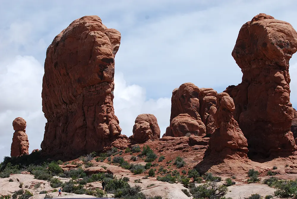
Long before anyone was selling t-shirts with Delicate Arch on them, this stretch of red rock spent about 65 million years quietly doing what sandstone does: sitting under an ancient sea, getting buried under salt deposits thousands of feet thick, and slowly buckling as that salt shifted beneath the surface. That underground salt movement cracked the sandstone into the parallel “fins” you’ll see everywhere in the park — think of them as nature’s row of dominoes, standing on end, waiting millions of years for wind and water to hollow them out into arches. There are more than 2,000 documented arches in the park today, which tells you Utah has been at this a lot longer than any of us.
Humans showed up considerably more recently. Ute and other Indigenous peoples used this land for thousands of years, and you can still see their mark at the Wolfe Ranch petroglyph panel along the Delicate Arch Trail — a short detour that’s worth the two extra minutes. European-American settlement arrived with the Wolfe family in the late 1800s; John Wesley Wolfe, a Civil War veteran, ran a small cattle operation here with his son, and their weathered cabin still stands near the Delicate Arch trailhead as one of the best-preserved homesteads in the park.
The “Arches” name itself came later, care of Frank Beckwith, who led a scientific expedition through the area during the winter of 1933–34 and is credited with naming both Landscape Arch and Delicate Arch. President Herbert Hoover had already designated the area a national monument in 1929 to protect the arches from what was, at the time, a real threat of mineral prospecting. It took until 1971 for Congress to upgrade Arches to full national park status, by which point the rest of us had finally caught up to what the Utes had known all along — this place is worth protecting.
Points of Interest You Shouldn’t Drive Past
Even if you never leave your car’s air conditioning (no judgment, see: my April thermometer story), these are worth the pull-off:
- Park Avenue — A canyon of towering rock fins that genuinely does look like a skyline, viewable from an overlook or via an easy 1-mile one-way walk if you can arrange a shuttle back to your car.
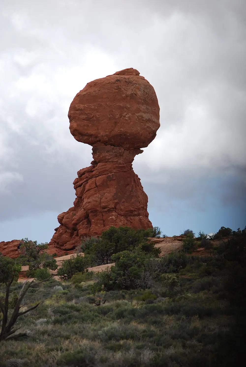
- Balanced Rock — A 3,577-ton boulder perched on a much thinner pedestal, doing its best impression of physics being optional. A 0.3-mile loop walk gets you all the way around it.
- Courthouse Towers — Massive freestanding monoliths, including the aptly named Three Gossips, visible right from the main road.
- Fiery Furnace — A labyrinth of narrow, twisting canyons and fins that requires a permit (self-guided or ranger-led) because it is genuinely easy to get lost in there, and rangers would prefer not to organize a search party for someone who “just wanted a quick look.”
- Salt Valley Overlook — A quieter, less-photographed viewpoint that gives you a sense of just how much of this landscape is the result of that ancient underground salt bed doing its slow, patient work.
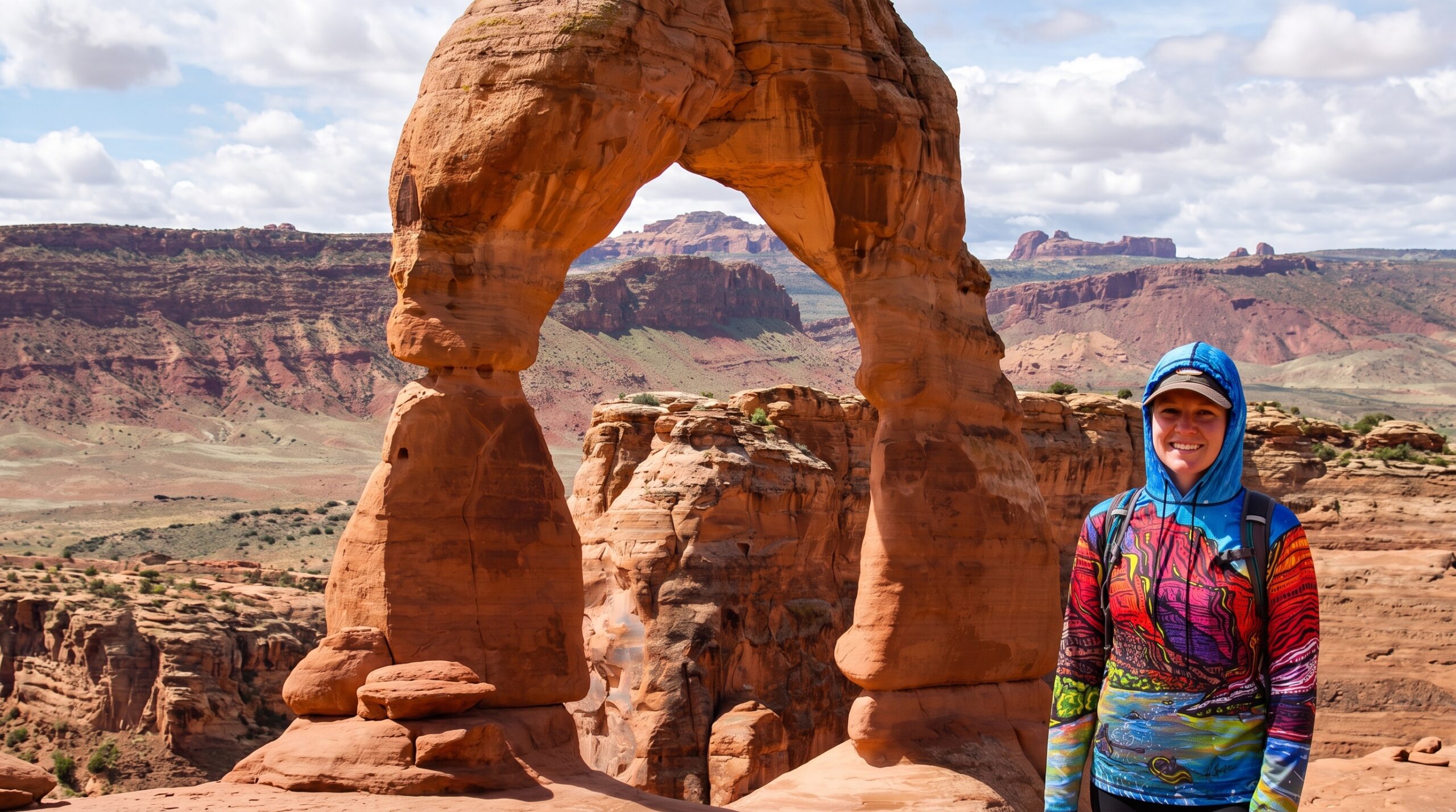
Delicate Arch
The Complete Trail Guide
Here’s every trail I hiked across three trips, plus the ones I wish I’d budgeted time for, organized easiest to hardest.
Windows Section Loop (North Window, South Window, Turret Arch)
- Distance: About 1 mile round trip for the full loop with the Turret Arch spur
- Elevation gain: Roughly 100–150 feet
- Difficulty: Easy
- Time: 30–60 minutes
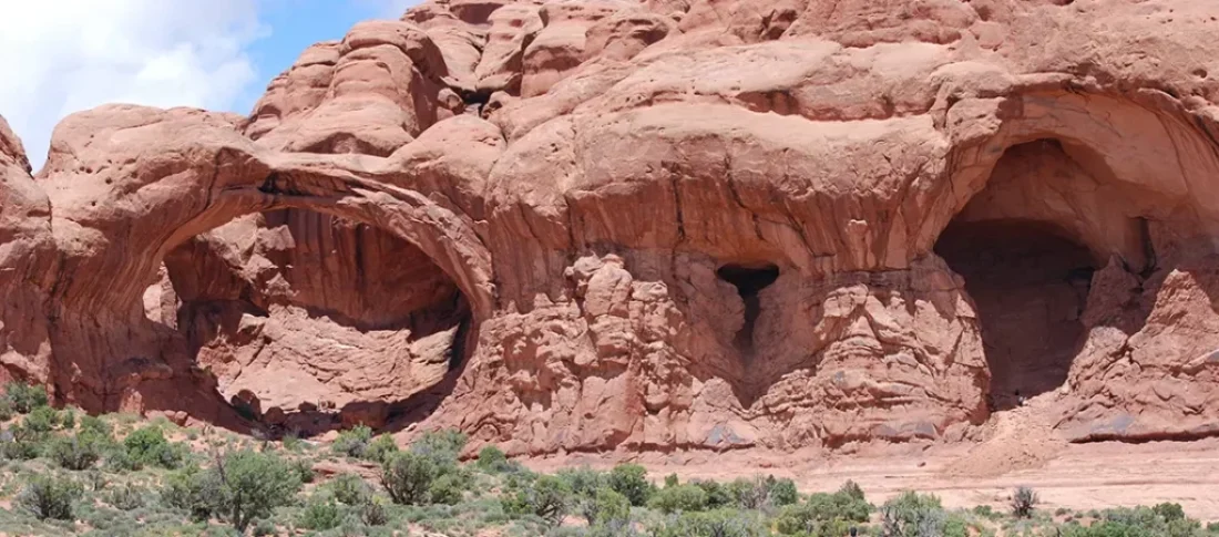
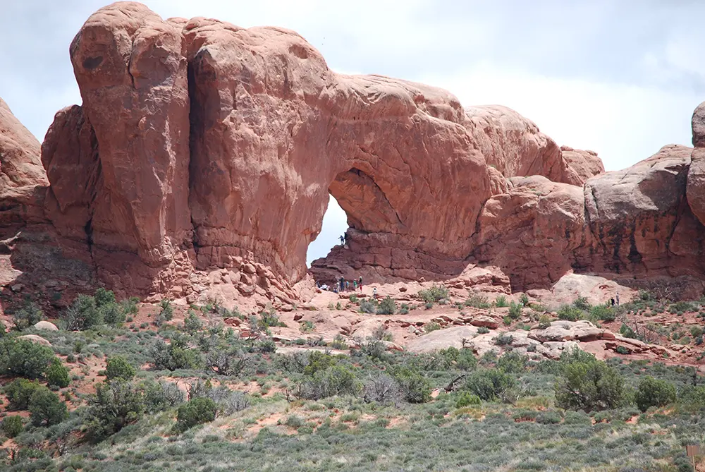
This is the trail I’d send my own mother on, and I mean that as the highest compliment. North Window looks like a giant stone eye socket staring out at the desert — locals call the pair of them “the Spectacles” — and South Window frames a postcard view of the La Sal Mountains, especially at sunrise. A short spur leads to Turret Arch, smaller and more delicate-looking, perched on what resembles a small sandstone castle. There’s also a “primitive” back trail around the formations if you want a little solitude away from the tour bus crowds, which does exist here despite the short distance.
(Image prompt: Sunrise light glowing orange through North Window Arch, Arches National Park, silhouetted hikers for scale, wide-angle landscape photography. Alt text: “North Window Arch sunrise Arches National Park Utah”)
Double Arch
- Distance: About 0.5 miles round trip
- Elevation gain: Minimal, mostly flat
- Difficulty: Easy
A short walk from the Windows parking lot to two arches sharing a single stone pillar. Unlike most arches in the park, Double Arch was carved from above by water erosion rather than from the side, which is either fascinating geology or a good excuse to stand in the shade for ten minutes. Both work.
Delicate Arch Trail (Wolfe Ranch)
- Distance: 3 to 3.3 miles round trip
- Elevation gain: Roughly 600–640 feet, cumulative
- Difficulty: Moderate
- Time: 2 to 2.5 hours
This is the hike on Utah’s license plate, and also the hike where I learned that “moderate” is a word national parks use the way real estate agents use “cozy.” The first half-mile is easy, rolling past the Wolfe Ranch cabin and the petroglyph panel. Then the trail turns onto open slickrock and climbs steadily with essentially zero shade for over a mile — the single biggest reason this hike ranks among the most heat-related-incident-prone trails in the park. Near the top, the trail rounds a rock wall and Delicate Arch appears in full, freestanding, 52 feet tall, with a genuinely vertigo-inducing bowl-shaped drop-off just in front of it. Get your photo, respect the drop-off, and go early or late — this trail is packed at midday and offers zero mercy from the sun.
Devils Garden Trail (Landscape Arch and Beyond)
This is the big one — the longest maintained trail in the park, and the one that turns from a Sunday stroll into a genuine adventure depending on how far you go. Treat it as three trails in one:
- To Landscape Arch: 1.8–1.9 miles round trip, about 20–260 feet of gain depending on the source you trust, easy, well-graded, and crowded. Landscape Arch itself is the reward — at roughly 290–306 feet long, it’s the longest natural arch in North America, and shockingly thin given its length. A slab broke off in 1991, so you can no longer walk directly underneath it, only view it from a respectful distance, which is honestly for the best given how thin it looks.
- To Double O Arch: 4.2 miles round trip, about 290 feet of gain, moderate to strenuous. Beyond Landscape Arch the crowds thin fast and the trail gets genuinely technical — climbing slickrock ramps between fins, with less obvious footing. Double O Arch is a rare double-decker arch formation and worth every bit of the scramble.
- Full Primitive/Dark Angel Loop: Roughly 7.7 to 9.2 miles depending on how many side spurs you take (Navajo Arch, Partition Arch, Tunnel Arch, Pine Tree Arch are all off this loop), with cumulative elevation gain reported anywhere from 1,050 to nearly 1,700 feet depending on your tracker and how many side arches you chase. This section demands good traction, real hiking shoes, comfort with exposure and scrambling, and a trail that isn’t always obviously marked. This is the trail I got turned around on for a genuinely alarming twenty minutes, chasing what I was certain was a well-marked path and was, in fact, a wash. Bring more water than seems reasonable. Bring a map. Don’t be me.
(Image prompt: Double O Arch stacked double-arch rock formation, dramatic blue sky, sandstone fins in foreground, dry desert scrubland, late afternoon light. Alt text: “Double O Arch Devils Garden trail Arches National Park Utah”)
Sand Dune Arch and Broken Arch (Bonus Easy Add-On)
- Distance: About 2 miles round trip combined
- Difficulty: Easy
If you have an extra hour, this pairing is criminally underrated. Sand Dune Arch sits tucked between narrow fins in soft, shaded sand — genuinely cool on a hot afternoon, both literally and figuratively — and a connecting trail leads across an open field to Broken Arch, which despite the name is fully intact and much less crowded than the park’s headline attractions.
Camping: Devils Garden Campground and Your Moab Backup Plan
Devils Garden Campground is the only campground inside the park boundary — 51 sites, reservable March 1 through October 31 through Recreation.gov, and they go quickly enough that I’d set a calendar reminder the moment your dates open up. The upside of scoring a site here is real: you wake up already inside the park, ahead of the day-trippers pouring through the entrance station, and you get first crack at Devils Garden before the parking lot fills.
Realistically, though, most visitors — myself included, on all three trips — end up basing out of Moab itself, about a 25-minute drive from the park entrance. Moab has no shortage of private campgrounds and RV parks along US-191 and the Colorado River corridor, plus extensive BLM camping (dispersed and developed) along Highway 128 and Kane Creek Road for anyone willing to trade hookups for river views and considerably more elbow room. Whichever you choose, book ahead during April, May, September, and October — Moab’s high seasons — because “we’ll just find something when we get there” is a plan that has ruined more than one trip I’ve heard about from other people. Definitely other people.
Photography Section: How to Not Take the Same Photo as Everyone Else
Every arch in this park has already been photographed roughly one billion times, so the real game is timing and light, not just showing up.
- Sunrise belongs to the Windows Section. South Window in particular frames the La Sal Mountains beautifully in early light, and you’ll often have the place mostly to yourself before the tour buses arrive.
- Sunset belongs to Delicate Arch. It’s the single most photographed spot in the park at golden hour for good reason, but that means you’re sharing the bowl in front of the arch with a genuine crowd — arrive at least an hour early to stake out a composition.
- Landscape Arch photographs best mid-morning to early afternoon, when light rakes across its impossibly thin span without blowing out the highlights.
- Don’t skip astrophotography. Arches is an International Dark Sky Park, and with timed entry no longer restricting after-hours access, a clear moonless night at Balanced Rock or the Windows parking area can produce Milky Way shots that make the daytime crowds worth it.
- Bring a polarizing filter for the deep blue-sky contrast against red rock that makes these formations pop, and a wide-angle lens for anything in the Devils Garden or Park Avenue areas where scale is the whole story.
- Protect your gear from the dust. Fine red sand gets into everything — lens caps on between shots, and a rocket blower is worth its weight in gold by day three.
Best Time to Visit (A Word From Someone Who Learned the Hard Way)
Every guidebook will tell you spring (April–May) and fall (September–October) are the “mild” shoulder seasons. This is technically true and also the reason I’ve stood at the Windows trailhead at noon in a genuine sweat-soaked stupor while the thermometer read 97 degrees — twice, in April, and once more just to be sure the lesson hadn’t sunk in. Daytime highs in the desert climb fast even in “mild” months, especially by midday, while mornings and evenings can still be genuinely cool, even cold before sunrise. The fix isn’t avoiding spring — it’s avoiding midday. Start hiking at first light, take a long air-conditioned lunch break in Moab between about 11 a.m. and 3 p.m., and go back out for golden hour. Summer (June–August) pushes well past 100 degrees regularly and should only be attempted by early risers with serious water discipline. Winter is genuinely lovely, cold, quiet, and nearly crowd-free, though ice on slickrock sections demands traction devices.
Quick FAQ
Do I need a timed-entry reservation for Arches in 2026? No. The National Park Service dropped the timed-entry requirement for the 2026 season. You still need a valid entrance pass, purchased online or at the gate.
Is there camping inside Arches National Park? Yes — Devils Garden Campground, 51 sites, reservable March through October via Recreation.gov. Most visitors otherwise stay in nearby Moab.
Which hike should I do if I only have one day? Delicate Arch at sunrise or sunset, then the Windows Section and Landscape Arch (the first easy mile of Devils Garden Trail) during the day. That combination hits the park’s greatest hits without requiring a full-day commitment to the Devils Garden Primitive Loop.
Do I need a permit for the Fiery Furnace? Yes, for both the self-guided and ranger-led options, booked through Recreation.gov, separate from your park entrance pass.
Final Word
Arches rewards planning and punishes assumptions — mine, specifically, about what “spring” means in a desert. Get an early start, drink more water than seems dignified, and go see Landscape Arch defy physics in person. Just don’t trust the thermometer’s opinion of what season it is. It lies.